|
|
|
The
Larpinta Trail in the West MacDonnell Ranges
in Central Australia, Northern Territory
Australia
A tourist selfdrive tourist guide and travel information
|
|
|
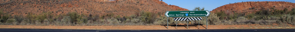
Larapinta Trail
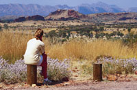
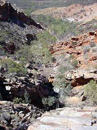
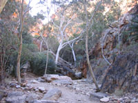
Situated in the heart of Central Australia, the Larapinta
Trail extends over 223 kilometres along the backbone
of the West MacDonnell Ranges. This exciting long distance
walking track is divided into 12 sections, each a 1-2
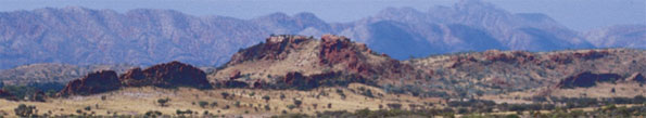
day walk. The Trail encompasses some of the key attractions
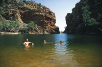
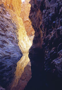
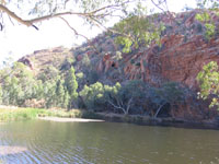
of the Ranges including Simpsons Gap, Ellery Creek Big
Hole, Ormiston Gorge and Glen Helen. The Trail also
links in with other walking tracks within the West MacDonnell
National Park, allowing side trips to explore more of
what the Park has to offer.
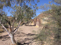
The Larapinta Trail begins at the old Alice Springs
Telegraph Station and meanders through many gaps and
sheltered gorges, climbs steeply over the rugged ranges,
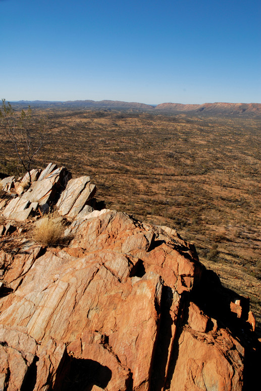
and has numerous stunning views and opportunities to
photograph or admire the spectacular landscape. The
Trail takes in a variety of desert habitats before rewarding
walkers with 360° vistas from Mt Sonder the highest
point and end of the Trail.
Larapinta 223
 Larapinta
223 refers to walkers trekking the whole 223 km of the
Trail from Alice Springs Telegraph Station to the summit
of Mt Sonder. The full traverse of the Larapinta Trail
is a remote and more difficult experience. This represents
a suggested itinerary of 20 days allowing for rest stops
and side walks. If you are planning to walk the whole
Trail, consider your physical ability, allow for rest
days, the inclusion of side walks and the need for re-supply
of food. You are encouraged to contact Parks and Wildlife
to discuss your plans. Larapinta
223 refers to walkers trekking the whole 223 km of the
Trail from Alice Springs Telegraph Station to the summit
of Mt Sonder. The full traverse of the Larapinta Trail
is a remote and more difficult experience. This represents
a suggested itinerary of 20 days allowing for rest stops
and side walks. If you are planning to walk the whole
Trail, consider your physical ability, allow for rest
days, the inclusion of side walks and the need for re-supply
of food. You are encouraged to contact Parks and Wildlife
to discuss your plans.
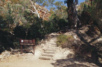 Each
section is accessible to vehicles (some by high clearance
4WD only), so you can join or leave the Trail at any
of the Trailheads. Each
section is accessible to vehicles (some by high clearance
4WD only), so you can join or leave the Trail at any
of the Trailheads.
You can tailor your walking experience by choosing
sections of interest to you and length of time you have
to spend on the Trail.
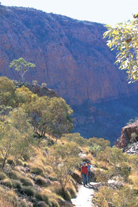
The Trail itself is made up of a range of grades catering
for hikers of varying abilities (see
walking track grades for the Larapinta Trail). All
walkers on the Trail need to have a good level of fitness
and must be well prepared and equipped.
|
|
|
|
|
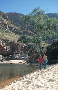
 Camping
out under a sea of stars in the outback is a highlight
of the Trail experience. Although they vary, most camp
sites offer picnic tables and hardened tent sites
all Trailheads have a water supply and some have free
gas barbecues (see the Facilities section for more detail). Camping
out under a sea of stars in the outback is a highlight
of the Trail experience. Although they vary, most camp
sites offer picnic tables and hardened tent sites
all Trailheads have a water supply and some have free
gas barbecues (see the Facilities section for more detail).
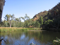
Whatever your motivation for walking the Trail...the
spectacular sunrises and sunsets, the inspiration, the
challenge or the window it provides to the varied and
fragile ecology
the beauty and grandeur of the Larapinta
Trail will leave a lasting impression long after your
visit to Central Australia.
The
facilities found at each Trailhead and designated camping
area vary from location to location, the table below
gives a quick overview of what facilities are at each
location.
Please refer to the Water Supplies section for the
location of water.
New
shelters are provided at Jay
Creek and Finke River Trailheads. Each shelter has
a free gas cooker, toilet, Ranger maintained water tank
and sleeping platform.
|
|
|
One Day Walks: There are endless ways
to walk the Larapinta Trail. You can opt for one of
the suggestions below or choose a combination that suits
you best.
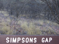
SECTION 1 - One Day Walk
(Alice Springs Telegraph Station to Simpsons
Gap) is a long walk and if attempting it in 1 day you
should start or finish at the Geoff Moss Bridge.
This will cut about 5km off your trip making the day
18.9km long (7.5hrs).
This is the best section to give you an idea of the
Trails terrain as the walking conditions vary markedly
and it is a medium grade section relatively close to
town.
Euro Ridge provides excellent views of Alice Springs
and the MacDonnell Ranges.
If you want to do a return walk to save organising
transport, you could walk from Geoff Moss Bridge to
Wallaby Gap and back again - 17.2km (7hrs).
Highlights:
Views over Alice Springs from Euro Ridge.
Walking towards Hat Hill Saddle.
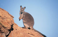
Arriving at Simpsons Gap to watch Black-footed Rock-wallabies
at dusk.
|
 |
|

|
|
|
SECTION 7 - One Day Walk
(Ellery Creek to Serpentine Gorge) is one of the most
overlooked sections as a day walk option, which makes
it appealing for people who want to enjoy some uninterrupted
walking.
This section is a relatively short one (13.8km / 5.5hrs)
however it is graded hard and like many other sections
of the Trail is very exposed to the elements. If starting
the walk from Serpentine Gorge it is well worth doing
a side trip up to Serpentine Gorge lookout.
Highlights:
Fascinating examples of Central Australian geology.
Dipping your toes in the cold water at Ellery Creek
Big Hole.
|
|
|
|
SECTION 8 - One Day Walk
(Serpentine Gorge to Serpentine Chalet Dam) is a challenging
one day walk as it includes a steep climb to the top
of Counts Point, which offers stunning panoramic views.
The walk is graded as hard, starting at Serpentine
Gorge and finishing at Serpentine Chalet Dam (or visa
versa) and would require a drop off and pick up. Another
idea is to park a car at either end. Section 8 is well
worth the effort if you enjoy a steep climb and descent
and want to be rewarded with one of the best views along
the Larapinta Trail. Access into Serpentine Chalet Dam
is by high clearance 4WD only, however you can walk
out along the access track past the ruins to the 2WD
area. Another option is to extend your walk by 6.3km
to the Ochre Pits via the Arrernte walk. The Ochre Pits
is accessible by 2WD.
Highlights:
Enjoying a well deserved break at Counts Point.
The views over the Alice Valley along the ridgeline.
Views of Mt Sonder in the distance.
|
|
|
|
SECTION 10 - One Day Walk
(Ormiston Gorge to Finke River) is one of the shortest
and most popular sections of the Larapinta Trail.
The terrain caters for those of average fitness used
to walking long distances.
It meanders between Ormiston Gorge and Glen Helen
Resort for just over 10km (4 -5hrs).
You can leave your car at Ormiston Gorge carpark and
get a transfer back with Glen Helen Resort (best to
book ahead).
The Resort is a great place to end your walk as it
sells snacks and refreshments. The scenery is varied
and includes a hilltop lookout as well as walking through
the dry Finke River.
Highlights:
Walking in one of the oldest rivers in the world.
Having a cool drink or ice-cream at Glen Helen Resort
after a good days walk.
|
|
|
|
SECTION 12 - One Day Walk
(Redbank Gorge to Mt Sonder return) is the only section
which starts and finishes at the same place.
It is the last section of the Trail and follows the
ascent of Mt Sonder. There are fantastic views all the
way, ending at a cairn on the summit. The beauty of
this section is you can walk as much or as little as
you like.
The climb is slow and steady and although its exhausting
youll be rewarded with great views especially on a
clear day.
It starts and finishes from the Redbank Gorge carpark
which involves driving for 5km on unsealed road from
Namatjira Drive. 4WD is not essential, but it is corrugated
and a high clearance vehicle is recommended.
Highlights:
Seeing the bright pink flowers of Mountain Hakea during
September & October.
Arriving at the top of Mt Sonder - the 4th highest mountain
in the Territory.
Getting a glimpse of Tnorala (Gosse Bluff) from the
top of Mt Sonder on a clear day.
|
|
|
|
2 days - Overnight
STANDLEY CHASM to TANGENTYRE JUNCTION and back
(Section 3)
This is a great option if you want to do a challenging
there and back walk rather than arranging transport
at both ends.
Park your car at Standley Chasm (privately owned and
operated, an entry fee applies). It is a good idea to
let the kiosk staff know that you are parking overnight
and returning the next day. Walk to Millers Flat and
take the high route to Tangentyere Junction.
Walk back to Millers Flat along the low route and camp
overnight. You may wish to set up camp at Millers Flat
and take a day pack for the rest of your walk.
Take your time to walk back to Standley Chasm the following
day.
Highlights:
Seeing Standley Chasm before the crowds of midday tourists
arrive. Breathing in the fresh air along the high route
after a challenging climb.
|

|
|
|
2 3 days - Overnight
ELLERY CREEK to SERPENTINE CHALET DAM or the OCHRE PITS
(Sections 7 & 8)
Start at Ellery Creek Big Hole and walk west to Serpentine
Gorge. Set up camp and if you have the energy, take
the walk up to Serpentine Gorge lookout.
The next day start early and walk the steep ascent
to the ridgeline and along to Counts Point.
Allow plenty of time along the ridge and at the lookout
to admire the views over the Alice Valley. Camp overnight
at Serpentine Chalet Dam.
The road past Serpentine Chalet Ruins towards the Trailhead
is 4WD access so a good alternative is to walk part
way along Section 9, drop your pack to have a look at
Inarlanga Pass and then finish at the Ochre Pits (2WD
access).
Alternatively, finish at the 2WD access point on the
Serpentine Chalet access road.
Highlights:
Having a long lunch at Counts Point. Embracing some
of the tourism history around Serpentine Chalet Dam
and Ruins.
|
 |
|
|
|
|
2 - 4 days - Overnight
ORMISTON GORGE to REDBANK GORGE
(Sections 10 & 11 or Sections 10, 11 & 12)
These Sections make for a great weekend walk and if
you have a long weekend try adding Section 12 as well.
This part of the Trail is very flexible and you can
walk them straight through or couple them with side
trips around Ormiston Gorge or to Glen Helen.
If youre fit and only have 2 days, walk from Ormiston
Gorge to Hilltop Lookout on Section 11 for an overnight
camp. Continue onto Redbank Gorge the following day.
If youve got more time on your hands consider camping
at Finke River, Rocky Bar Gap and then Redbank Gorge
with an early morning walk up Mt Sonder on day 4.
Highlights:
Walking in the shadows of Mt Sonder.
Watching birds make the most of each habitat that you
pass through - from the mallee to the spinifex to the
River Red Gum lined watercourses and the ranges.
|
|
|
|
4 - 5 days - Overnight
STANDLEY CHASM to ALICE SPRINGS
(Sections 3, 2 & 1)
Start at Standley Chasm (privately owned and operated,
an entry fee applies) and walk Sections 3, 2 and 1 to
Alice Springs Telegraph Station over 4 or 5 days.
You can then walk from the Telegraph Station into the
centre of Alice Springs along the Riverside Walk or
take a 10 minute taxi ride into town.
Highlights:
Walking past ancient Cycads around the shelter of Standley
Chasm.
Taking the high route to Tangentyere Junction for spectacular
views (only for those who really want to get the heart
racing!)
Getting your first view of Alice Springs on the way
back into town.
|
|
|
|
5 - 6 days - Overnight
FINKE RIVER to ELLERY CREEK
(Sections 10, 9, 8 & 7)
Start at Glen Helen Resort and walk to Ormiston Gorge
along Section 10. Spend some time exploring Ormiston
Gorge and camp there overnight. The next day walk Section
9 over 2 days, and camp at Waterfall Gorge. There is
no water supply along Section 9 so be prepared to carry
2 days worth of water. Walk Section 8 in 1 day to Serpentine
Gorge and then walk Section 7 in 1 day to Ellery Creek
Big Hole.
Highlights:
Taking the time to do the Ormiston Pound side trip without
a pack.
Arriving at the top of Counts Point and encountering
one of the best views on the Trail.
Taking in the unique geology around Serpentine Gorge
and Ellery Creek.
|
|
|
|
6 - 7 days - Overnight
REDBANK GORGE to ORMISTON GORGE or the OCHRE PITS
(Sections 10, 11 & 12 or Sections 9, 10, 11 & 12)
Start at Redbank Gorge, walk Section 12 with a day
pack and camp the night back at Redbank Gorge. The next
day walk Section 11 and camp at either Rocky Bar Gap
or Finke River (Section 11 will take 2 days if camping
at Rocky Bar Gap or 1 big day if camping at Finke River
depending on your level of fitness).
From Finke River walk Section 10 to Ormiston Gorge.
Ormiston Gorge is great spot to stay for a couple of
days to explore the Gorge and do some side walks. Alternatively
you can carry on to walk Section 9 over 2 days, camping
at Waterfall Gorge. There is no water supply along Section
9 so walkers must be prepared to carry 2 days worth
of water. You have the option of coming out of Section
9 at the Ochre Pits which is accessible by 2WD and an
easier place to be picked up than Serpentine Chalet
Dam.
Highlights:
Watching the sunset behind Mt Sonder and getting some
unbeatable photo opportunities.
Taking a side trip to Glen Helen for a warm dinner and
a cold drink.
Camping in the Finke River under a sea of stars.
|
|
|
|
Up for an Extra Challenge?
2 days - Overnight
SERPENTINE CHALET DAM to ORMISTON GORGE
(Section 9)
Section 9 is one of the longest sections on the Larapinta
Trail and requires walkers to carry 2 days worth of
water. There is no tank provided and no reliable surface
water along the way. However if you are prepared to
carry a heavy pack with a considerable amount of drinking
water then this section provides spectacular views.
When you arrive at Ormiston Gorge be sure to swap to
a day pack and do the 3-4 hour Ormiston Pound Walk
you wont be disappointed!
Serpentine Chalet Bush Camping Area
Namatjira Drive Alice Springs NT 0870 Australia
Phone: 088951 8250 Fax: 088951 8290
URL: Serpentine
Chalet Bush Camping Area
Highlights:
Views of Mt Giles,
Alice Valley and Ormiston Pound from the Lookout.
Catching a glimpse of a Black-footed Rock-wallaby or
a Euro as you get closer to Ormiston Gorge.
|
|
|
|
Up for an Extra Challenge?
4 - 5 days - Overnight
ELLERY CREEK to STANDLEY CHASM
(Sections 4, 5 & 6)
Start at Ellery Creek, walk Section 6 (2 days) and
camp at Rocky Gully on the first night where there is
a ranger maintained water tank. Next camp at Hugh Gorge.
From Hugh Gorge walk Section 5 in 1 day to Birthday
Waterhole.
Section 4 can be walked in 1 hard day or a more leisurely
2 days to Standley Chasm. Section 4 and 5 are remote
and spectacular sections, but also the most physically
demanding on the Trail so it is best to allow plenty
of time.
Highlights:
Walking two of the most difficult, but scenically rewarding
sections of the Trail.
Taking in the 360 degree views from the top of Brinkley
Bluff (or for the worlds best sunrise try camping there!)
Walking from the exposed ridgelines of the Chewings
Range to the sheltered gorges around Standley Chasm.
|
|
|
|
|
|
Up for the Max Challenge?
Larapinta 223 (end to end): 20 days - Overnight
ALICE SPRINGS TELEGRAPH STATION to MT SONDER
(Sections 1 12)
'Larapinta 223' refers to walkers trekking
the entire 223 kilometres from the Alice Springs
Telegraph Station to the summit of Mt Sonder (Sections
1 to 12). It is suggested that you allow 20 days for
this remote and difficult adventure, allowing for rest
stops, side trips and to restock food supplies. There
are no restrictions on which direction you walk. Either
way you will encounter some challenging climbs and descents,
spectacular views and scenery like nowhere else in the
world. Many people choose to walk the Trail from west
to east (Mt Sonder to Alice Springs) because they can
get dropped off at Redbank Gorge and finish in town
at their own pace. However if you are happy to finish
your walk at a time set by your transfer back to Alice
Springs then perhaps this is the option for you. All
of our Trail notes are written from east to west and
there is nothing quite like finishing off your walk
with the goal of Mt Sonder creeping closer and closer.
Dont forget to organise several food drops along the
way and if you are walking from east to west (Alice
Springs to Mt Sonder), be sure to organise a pick up
from Redbank Gorge before you depart (see the links
and contacts page for companies who provide these services).
Walking from east to west also allows you to make food
drops on the way out to your starting point. This way
you will know exactly where they are!
Please feel free to contact
us at NT Parks for more information about attempting
the entire Trail.
Please Note: All
of the above recommendations are based on walking between
April and October with 2 or more people.
For more information about the safety and logistics
of walking the Larapinta Trail please read the information
on our website carefully and purchase a copy of the
Larapinta Trail Package for more detail including trail
notes and detailed maps.
Preparation and planning is the key to a safe and
enjoyable walk. We recommend that all walkers register
with the Overnight Walker Registration Scheme.
Larapinta
Trail Current Conditions and Updates - see http://www.nretas.nt.gov.au/
Facilities along the Larapinta Trail
Grades of trekking and hiking along the Larapinta Trail
All Larapinta Trail walkers should
Australian
Weather Observation for Alice Springs
Food Drops & Storage Facilities along the Larapinta
Trail
Safety on the Larapinta Trail
The
Larapinta Trail Package a one-stop-shop of essential
information for all walkers embarking on Larapinta Trail.
Water Supplies on the Larapinta Trail
Suggested Itineraries for trekking and hiking the Larapinta
Trail
Camping Gear to buy in Alice Springs
Register
with the Overnight Walker Registration Scheme for the
Larapinta Trail
Dont risk your life plan your walk between April
and October
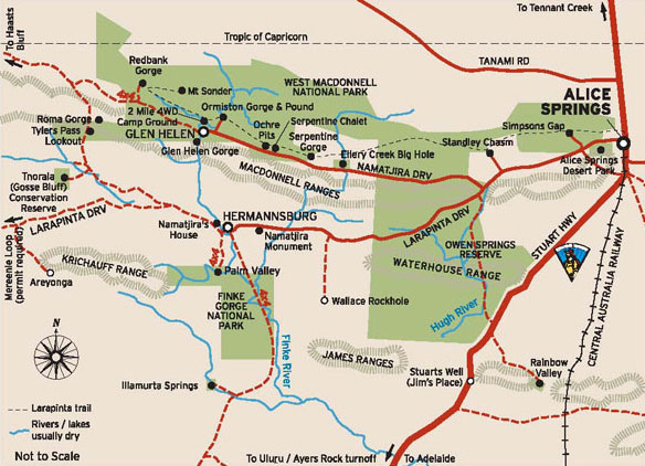
Maps
of the Larapinta Trail - see http://www.nretas.nt.gov.au/
Maps of the Larapinta Trail on Section 1 to 12
|
|
|
|
|
|
|
Find a self drive 4wd hire, camper,
motorhome or camper rental from Alice Springs
to Uluru and return or oneway to Darwin via
Kakadu and Litchfield.
See our specials at Australia
4wd Rentals or email
and ask us. Minimum rental is 5 days. Ask
us how to reserve a vehicle for only AUD $100
up to 9 months from travel.


|
|
|
Photographs Courtesy Of: NTTC
- Northern Territory Tourism Commission.
Maps Courtesy Of: NTTC - Northern Territory
Tourism Commission.
Photographs Courtesy Of: PJ B &
M Hutchinson Private Collections
Information courtesy of Parks and Wildlife Service NT
for the promotion of tourism for the Larapinta Trail.
Photographs
Courtesy of NTTC - Northern Territory
Tourism Commission
Information
courtesy of Parks Northern Territory
The Goholi
Our Mission Statement
As one of Australia's largest licensed
Travel Agents Goholi is dedicated to campervan and motorhome
hire and rentals. We will source the different options
for you. We will look at all the extras and find the
best vehicle package for you or even a multiple option
for you to choose from. With our head Office in the
heartland of the Top End of Darwin we can advise you
of the current situations of Uluru Kata Tjuta National
Park - Ayers Rock, Watarrka National Park, West MacDonnell
Ranges, East MacDonnell Ranges, Kakadu National Park,
Uluru (Ayers Rock), Gibb River Road Western Australia
and the - Erldunda - Kulgera - Oodnadatta Track - Coober
Pedy (Opal field) - Woomera - Port Augusta areas.
East MacDonnell National Park
and West MacDonnell National Park
in the MacDonnell Ranges in Northern Territory, Central
Australia
A tourist selfdrive tourist guide and travel information
East MacDonnell National Park
and West MacDonnell National Park in Central Australia
West
MacDonnell Map West
MacDonnell National Park East
MacDonnell National-Park
East
MacDonnell Map
West MacDonnell National Park
and surrounding areas
Larapinta
Trail Glen
Helen Gorge Glen
Helen Lodge accommodation Ellery
Creek Big Hole Ochre
Pits Ormiston
Gorge Redbank
Gorge Waterhole Roma
Gorge Serpentine
Chalet Serpentine
Gorge Simpsons
Gap Standley
Chasm
Honeymoon
Gap Palm
Valley
Albert
Namatjiras Monument
Namatjira
Drive Namatjira
Twin Gums Hermannsburg
Ghost
Gum Wallace
Rockhole Palm
Valley
East MacDonnell National Park
and surrounding areas
Arltunga
Historical Reserve and hotel or camping Trephina
Gorge Emily
Jessie Gap Corroboree
Rock Ross
River Resort Ruby
Gap N'Dhala
Gorge Nature Reserve Gemtree
Chambers
Pillar Rainbow
Valley
Other Highways, Scenic Routes,
Ways, offroad 4wd Tracks and Roads in Central Australia
The
Mereenie Loop Red
Centre Way Explorers
Way Stuart
Highway Ernest
Giles Road Namatjira
Drive Larapinta
Drive Luritja
Road Lasseter
Highway Binns
Track
Top End - Natures Way in Northern
Territory Australia
Darwin
Tropical
Darwin Map
of Northern Territory Katherine
Gorge Tennant
Creek Devils
Marbles Kakadu
National Park Natures
Way Top End Katherine
Gorge Litchfield
National Park
Alice Springs and Uluru and on
the way
Alice
Springs Alice
Springs Airport The
Ghan Alice Springs Alice
Springs Heavitree Gap Uluru
Kata Tjuta National Park
Uluru
Ayers Rock Ayers
Rock Resort at Yulara Voyages
Resort at Ayers Rock Resort, Yulara Ayers
Rock Airport 'Connellan Airport' Kata
Tjuta 'The Olgas' Sounds
of Silence dinner Mount
Sonder Mount
Connnor Mount
Ebenezer Curtin
Springs Stuarts
Well Erldunda
Kings Canyon
Watarrka
National Park Kings
Canyon Kings
Creek Station Kings
Canyon Resort Glen
Helen Lodge accommodation
Remote access sites
Henbury
Meteorites Conservation Reserve Gosse
Bluff Tnorala Tylers Pass Haasts
Bluff - lkuntji
Alice Springs camper hire and
Alice Springs motorhome rentals return and one way
Alice
Springs campervan hire and camper rentals
Alice Springs
motorhome hire and RV rentals
Alice Springs 4wd hire | Alice
Springs 4 wheel drive rentals | Alice Springs 4X4 hire
4WD Hire
from Alice Springs with oneways to Darwin
Uluru guided camping tours and
Kakadu guided camping safaris
Across Australia
Adventure Tours at http://www.australia4tours.com/
Uluru
Northern Territory www.uluruadventuretours.com
Kakadu
Northern Territory adventure tours and safaris at www.kakaduadventuretours.com
Way outback
Ayers Rock adventure tours and safaris at www.ulurusafaris.com
Way outback
Kakadu and Litchfield adventure tours and safaris at
www.kakadusafaris.com
Instant availability
on Kakadu and Top End one day tours www.kakaduholidays.com/
Instant
availability on Darwin one day tours www.darwin4tours.com/
Search, find and about West
MacDonnell National Park and East MacDonnell National
Park the MacDonnell Ranges in Central Australia a resource
travel guide.
|
|