|
|
|
Explorers Way - Darwin to
Alice Springs section
This section is the Stuart Highway from Alice Springs
to Darwin
A tourist selfdrive tourist guide and travel information
Northern, Territory Australia
|
|
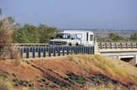
| Darwin
- End or Start of the Explorers Way
Important Note: If you are replying solely facilities
at certin remote roadside petrol stations, shops and
parks then it's always wise to ring ahead. This is the
outback and as an example only if a EFTPOS machine breaks
it may take a few days to fix.
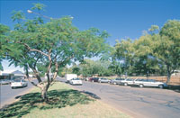
Darwin: The Capital city of Northern
Territory, Australia is Darwin. Now Darwin is closer
to Jakarta than to Sydney, and also closer to Singapore
than to Melbourne.
It is not really a surprise then that Darwinians looks
to Asia for travel, influences in dress and food as
much as it looks south to the rest of Australia.
Darwin's proximity and relationship such as its sister
city program with the Northern Territory's northern
neighbours is reflected in Darwin's cosmopolitan and
relaxed tropical atmosphere and culture.
Darwin: Map
of northern Territory
This is the most popular town and also the Territorial
capital of the Northern Territory (The Northern Territory,
sometimes referred to as the Last Frontier).
Also the Northern Territory is known as the Gateway
to Australias Adventure Playground, with over 10,000
kms of uninhabited coastline. The town of Palmerston
now the city of Darwin was founded by William George
Goyder Surveyor General of South Australia in the
19th century.
It is a city which a population at last glance of Darwin
District - 110 280, Darwin - 70 055, Palmerston - 24
123, Litchfield (Rural Darwin) - 16 642 inhabitants
with a large proportion of Aboriginal people, which
justify the fact that the town is often called 'the
multicultural capital of Australia'.
The population varies as the Dry Season arrives so
does an influx of workers for the harvest, mining and
tourist season.
History: Port Darwin was discovered
by Lieutenant John Lort Stokes and named by Captain
J.C. Wickham when, travelling in the HMS Beagle, they
passed the harbour area in 1839. Now apparently Capt.
Wickham named the area after Charles Darwin who had
once sailed in the HMS Beagle.
In 1869 it was renamed Palmerston but in 1911 it reverted
back to being named Darwin. Did you know the British
tried to established settlements first at Escape Cliffs,
Port Essington and Fort Dundas on Melville Island though
they failed.
Warning: Please do not take for granted
facilities: This is the outback and services like EFTPOS
can be awaiting maintenance. Try to ring ahead if this
is a major sevice you require to see that it's avaiable.
|
|
|
|
|

|
|
|
|
|
Palmerston
 History
of the city of Palmerston, Northern Territory. It is
app. 22km SE of the Darwin CBD Palmerston is relatively
new, having been established in 1981 as a satellite
of Darwin. In August 2000 when our population reached
23,000, now around 25,000. The City of Palmerston offices
are located on the corner of Chung Wah Tce and University
Ave. Office hours are: 8.15am - 5pm Monday to Friday
(excluding public holidays). Contact our Customer Service
Officers on 08 8935 9922. Suburbs: Archer,
Bakewell, Bellamack, Durack, Driver, Farrar, Gray, Gunn,
Marlow, Lagoon, Mitchell, Moulden, Palmerston, City,
Pinelands, Rosebery, Woodroffe , Yarrawonga. www.palmerston.nt.gov.au/ History
of the city of Palmerston, Northern Territory. It is
app. 22km SE of the Darwin CBD Palmerston is relatively
new, having been established in 1981 as a satellite
of Darwin. In August 2000 when our population reached
23,000, now around 25,000. The City of Palmerston offices
are located on the corner of Chung Wah Tce and University
Ave. Office hours are: 8.15am - 5pm Monday to Friday
(excluding public holidays). Contact our Customer Service
Officers on 08 8935 9922. Suburbs: Archer,
Bakewell, Bellamack, Durack, Driver, Farrar, Gray, Gunn,
Marlow, Lagoon, Mitchell, Moulden, Palmerston, City,
Pinelands, Rosebery, Woodroffe , Yarrawonga. www.palmerston.nt.gov.au/
|
|
|
 Howard
Springs is a town and community in a (now semi) rural
area on the outskirts of Darwin, 30 kilometers from
the centre of town. In 2009 it is often referred as
a rural suburb of Darwin. Most of the area is 5 hectarce
blocks of land that are either mango plantations or
home lots. Now a very desirable location to live properties
in Howard Springs are snapped up very quickly when they
become available. Howard Springs has a local supermarket,
Big 4 Tourist Van Park newsagency and a service station.
Mango farms and picturesque rustic surrounds make it
a relaxing base from which to explore Darwin. Howard
Springs is a town and community in a (now semi) rural
area on the outskirts of Darwin, 30 kilometers from
the centre of town. In 2009 it is often referred as
a rural suburb of Darwin. Most of the area is 5 hectarce
blocks of land that are either mango plantations or
home lots. Now a very desirable location to live properties
in Howard Springs are snapped up very quickly when they
become available. Howard Springs has a local supermarket,
Big 4 Tourist Van Park newsagency and a service station.
Mango farms and picturesque rustic surrounds make it
a relaxing base from which to explore Darwin.
Howard Springs Nature Park
Howard Springs Nature Park protects 283 ha of diverse
habitats including monsoon forest, extensive swamps
and riverine areas. These areas provide valuable wildlife
habitats, especially for Magpie Geese, Whistling Ducks,
Radjah Shelducks and Pygmy Geese. The Park is approximately
35 km south of Darwin. Turn east off the Stuart Highway
onto Howard Springs Road.
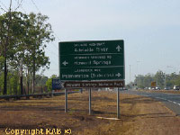
Turn off onto the Arnhem Highway to Kakadu
National Park
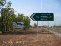 Down
the highway around 35klm now from Darwin you see the
Arnhem Highway on the left with a sign saying Humpty
Doo and Jabiru. The first sight of interest along the
highway is the didgeridoo workshop, actually at the
beginning but it's on the right of the road. Humpty
Doo, here is another fuel stop and the home to the Boxing
Crocodile though it a great photo snap for the kids
to be in it. It seems to be an obsession with Australian's
to have the biggest icon's. Humpty Doo is a large sprawling
country suburb of the outer Darwin region. Point of
Interest on humpty Doo: Humpty Doo is a town some 10klm
from the beginning of the Arnhem Highway with around
2829 residents on 5-20 acre farms with some 1006 households
in the area. I mentioned this as Humpty Doo seemed to
stretch along the highway quiet a bit. I forgot to mention
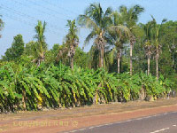
Further out the properties are larger and mostly farmed
as Mango Plantations. Can you imagine the aroma driving
with the window down when there in season around October/November
(there was a small crop at the beginning of September
also). Down
the highway around 35klm now from Darwin you see the
Arnhem Highway on the left with a sign saying Humpty
Doo and Jabiru. The first sight of interest along the
highway is the didgeridoo workshop, actually at the
beginning but it's on the right of the road. Humpty
Doo, here is another fuel stop and the home to the Boxing
Crocodile though it a great photo snap for the kids
to be in it. It seems to be an obsession with Australian's
to have the biggest icon's. Humpty Doo is a large sprawling
country suburb of the outer Darwin region. Point of
Interest on humpty Doo: Humpty Doo is a town some 10klm
from the beginning of the Arnhem Highway with around
2829 residents on 5-20 acre farms with some 1006 households
in the area. I mentioned this as Humpty Doo seemed to
stretch along the highway quiet a bit. I forgot to mention
Further out the properties are larger and mostly farmed
as Mango Plantations. Can you imagine the aroma driving
with the window down when there in season around October/November
(there was a small crop at the beginning of September
also).
|
|
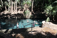
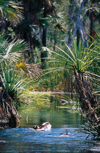
Berry Springs Nature Reserve
Berry Springs Nature Park protects a large part of
the Berry Creek catchment. Berry Creek begins as a series
of springs, forms a small creek, then reaches Darwin
Harbour through a mangrove lined estuary. The Park provides
an attractive area close to Darwin for recreational
activities, and also provides a refreshing swimming
spot after a day at the Territory Wildlife Park. If
you swim with goggles you can see many small native
fish and other aquatic life that live in the clear pools.
The Park is open from 8.00 am to 6.30 pm daily
Turn west off the Stuart Highway about 47 km south
of Darwin. The Park is 10 km along the Cox Peninsula
Road.
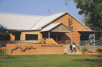
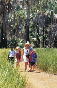
Territory Wildlife Park
Visiting Australia's Northern Territory? Home to an
array of flora and fauna the Territory Wildlife Park
showcase one of the worlds finest nature Parks. Situated
in Berry Springs, a 45 minute drive south of Darwins
CBD, and conveniently located next door to Berry Springs
Nature Reserve the Territory Wildlife Park truly is
the Territorys wildest wildlife experience!
At the Territory Wildlife Park, not only do you see
wildlife up-close in their natural habitats, you meet
them walking through tree top aviaries, strolling around
a natural lagoon and even get to interact with them
during daily presentations.
You stroll beneath the surface in our walk-through
aquarium and meet some of the Top Ends most amazing
aquatic life. You meet, nose to nose, with our giant
Saltwater croc. Its the closest youll ever get to
a salty without risking a scratch! Our experienced team
love sharing their knowledge of the wildlife and the
habitats in their care. Its what our people are passionate
about. The more you ask, the happier they are to share.
URL:www.territorywildlifepark.com.au/
|
 |
|
|
|
|
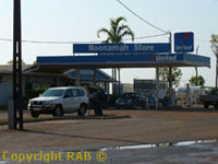
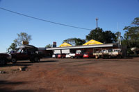
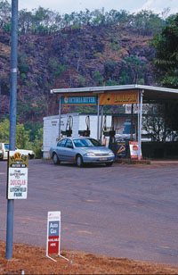
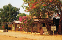
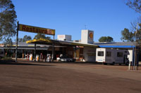
The Noonamah Store
The Noonamah Tavern
The Noonamah Hotel and Cafe
 Noonamah
Store, Noonamah Tavern and 'United' Fuel Stop The Noonamah
Hotel, Cafe and Fuel Stop is on the Stuart Highway,
Northern Territory, Australia. Noonamah is a small town
just 46km from Darwin. Noonamah itself consists of pub
and a general store/service station. The Darwin commercial
Crocodile Farm is located here with over 7000 crocodiles
and American alligators. Noonamah
Store, Noonamah Tavern and 'United' Fuel Stop The Noonamah
Hotel, Cafe and Fuel Stop is on the Stuart Highway,
Northern Territory, Australia. Noonamah is a small town
just 46km from Darwin. Noonamah itself consists of pub
and a general store/service station. The Darwin commercial
Crocodile Farm is located here with over 7000 crocodiles
and American alligators.
Noonamah 'United' Fuel Stop
 Noonamah
'United' Fuel Stop is excellent for campervans and 4WD
rentals as there is ample car p-arks and even for larger
motorhomes and RV's. Noonamah was first settled during
World War II when the army set up a series of airstrips
and depots in the area. Despite being bombed by the
Japanese, the airstrips still remain to this day. Noonamah
'United' Fuel Stop is excellent for campervans and 4WD
rentals as there is ample car p-arks and even for larger
motorhomes and RV's. Noonamah was first settled during
World War II when the army set up a series of airstrips
and depots in the area. Despite being bombed by the
Japanese, the airstrips still remain to this day.
Lake Bennett Wilderness Resort
Katherine to Lake Bennett, 260 kms
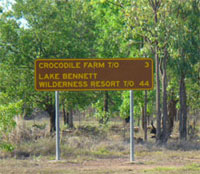 From
the Stuart highway it is 44klm to the Lake Bennett Wilderness
Resort. The flora along the Stuart Highway varies from
exotic palms to low lying scrub land known also as bush. From
the Stuart highway it is 44klm to the Lake Bennett Wilderness
Resort. The flora along the Stuart Highway varies from
exotic palms to low lying scrub land known also as bush.
The Resort is set around the shores of an 81 hectare
fresh water lake located within 125 hectares of tropical
Australian bush land. A destination without exception,
just one hours drive south of Darwin. For more information
email Lake Bennett or browse our pages. Lake Bennett
Wilderness Resort is influenced by the cultural diversity
and the distinct Australian Outback characteristics
of the Northern Territory. 2002 winner of the Brolga
Award for Unique Accommodation. We are located just
87 km from Darwin City. http://www.lakebennettresort.com.au/
Acacia Hills
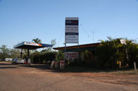 Acacia
Fuel Stop which is located along side the Acacia Camping
and Van Park. Acacia
Fuel Stop which is located along side the Acacia Camping
and Van Park.
Acacia Store and Camping Park
 Acacia
Cafe Acacia, Noonamah Acacia
Cafe Acacia, Noonamah
Tel: +61 (0)8 8988-2111 (Last known tel number)
|
|
Turn off to Batchelor
then onto Litchfield National Park
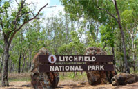
Litchfield
National Park to Darwin, 130 kms
If you travel from Darwin the road to Litchfield National
Park one takes is usually via the sealed road called
the Stuart Highway. Batchelor Road meets the Stuart
Highway about 92klm down from Darwin.
Then the Batchelor winds into Batchelor and from Batchelor
you drive into Litchfield National Park on Litchfield
Park Road.
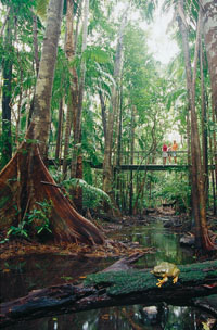
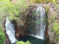
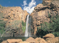
Visit nearby Litchfield National Park and see stunning
waterfalls and amazing termite mounds - and swim safely
in crystal-clear swimming holes. Enjoy the first glimpse
of the Timor Sea by following the Explorer's Way right
into the heart of Darwin.
Together with stunning tropical waterfalls and swimming
holes, this is a truly beautiful destination found just
south of Darwin, the capital city of the Northern Territory.
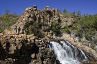
Litchfield National Park features numerous waterfalls
which cascade from a sandstone plateau called the Tabletop
Range, monsoon rainforests, intriguing magnetic termite
mounds and historical sites. Litchfield National Park
is chosen by local Darwin residents and tourists as
1-3 day destination for it's waterfalls and magnetic
termite mounds. Also noted are the 4WD tracks into some
of the more remote parts of Litchfield National Park
and surrounding region.
|
 |
 |
|
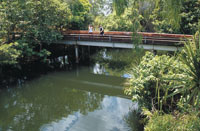
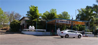
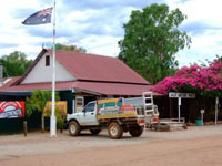
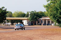
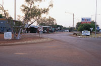
Adelaide River
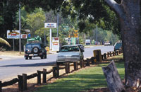 Adelaide
River (Wairia). The photo on the left
shows the Adelaide River main street. OK it's not 5th
avenue though it can busy we have seen 8 cars here at
once. Adelaide
River (Wairia). The photo on the left
shows the Adelaide River main street. OK it's not 5th
avenue though it can busy we have seen 8 cars here at
once.
The township of Adelaide River lies on the Stuart Highway
201 km northwest of Katherine and 114 km south of Darwin
and has a population of 159. It is located near the
headwaters of the Adelaide River.
 There
is a WW11 cemetary there also. There
is a WW11 cemetary there also.
 Adelaide
River, being about halfway between Southport and Pine
Creek, became a popular camping spot and so, in 1873,
an enterprising man named Dougherty opened up an eating
place. 'e constructed a rough building out of logs and
bark. Adelaide
River, being about halfway between Southport and Pine
Creek, became a popular camping spot and so, in 1873,
an enterprising man named Dougherty opened up an eating
place. 'e constructed a rough building out of logs and
bark.
A short time later H. S. Finlay opened the settlement's
first hotel which he called the QCE Hotel meaning 'Quiet,
Comfort and Ease'. In 1879 a police camp was built at
the river crossing.
Adelaide River Show Society Caravan Park
Phone: + 61 (0) 8 8976 7032
Fax: + 61 (0) 8 8976 7065
Location: Dorat Road Adelaide
River, Adelaide River NT 0846
Adelaide River Inn Caravan Park
Location: Stuart Highway Adelaide River.
Phone: + 61 (0) 8 89767047
Shady River Caravan Park
Location: War Memorial Dve off Stuart
Hwy Adelaide River NT 0846
Phone: + 61 (0) 88976 7047
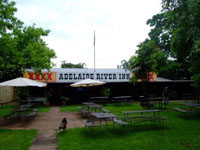 Historic
hotel offering motel accommodation and caravan park,
plus food, fuel, amenities, gaming room and beer garden.
Motel accommodation, caravan park and campground (pets
allowed-weekly rates on application), Counter meals,
cooked country style breakfast, tropical garden surrounds
and relaxing atmosphere, 'Charlie the Buffalo' (deceased)
the star of Crocodile Dundee 1&2, the 303 Bar, Fuel
and Auto gas, Takeaway meals. Historic
hotel offering motel accommodation and caravan park,
plus food, fuel, amenities, gaming room and beer garden.
Motel accommodation, caravan park and campground (pets
allowed-weekly rates on application), Counter meals,
cooked country style breakfast, tropical garden surrounds
and relaxing atmosphere, 'Charlie the Buffalo' (deceased)
the star of Crocodile Dundee 1&2, the 303 Bar, Fuel
and Auto gas, Takeaway meals.
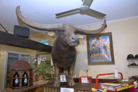 'Charlie
the Buffalo' (deceased) the star of Crocodile Dundee
1&2, the 303 Bar, Fuel and Auto gas, Takeaway meals. 'Charlie
the Buffalo' (deceased) the star of Crocodile Dundee
1&2, the 303 Bar, Fuel and Auto gas, Takeaway meals.
www: Adelaide River Inn
Email: adelaideriverinn@bigpond.com.au
Phone: + 61 (0) 8 8976 7047
Fax: + 61 (0) 8 89 76 7181
Location: 106 Stuart highway,
Adelaide River NT 0846
Adelaide River Inn Caravan Park War Memorial Drive Adelaide
River NT 0846
|
|
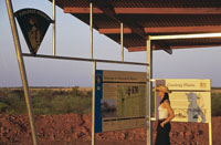
Adelaide River
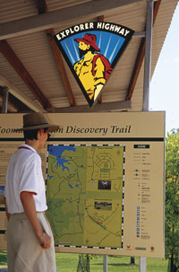 Adelaide
to Darwin - this route is known as the Explorers
Way. At Adelaide River there is a information
stand and the Discovery Trail information sign. Adelaide
to Darwin - this route is known as the Explorers
Way. At Adelaide River there is a information
stand and the Discovery Trail information sign.
Community Events For information
about local events mainly at local showground. The
events being the Adelaide River Show and Country Music
Talent Quest usually held in June and the Adelaide
River Races. We suggest you visit www.arss.org.au
Events
Adelaide
River Show
NT
Country Music Talent Quest
Adelaide
River Races
Address: Dorat Road, Adelaide River
Post: c/o Adelaide River Post Office, 0846
E-mail: info@arss.org.au
Office/Bar - Phone: + 61 (0) 8 89
767 041
|
|
|
Hayes Creek
 Located
on the Stuart Highway, 150 kilometers south of Darwin,
Hayes Creek is a gateway to World War II sites and the
Northern Goldfields loop with easy access to Litchfield
National Park, Batchelor, Pine Creek and the Tjuwaliyn
(Douglas) Hot Springs Park. Located
on the Stuart Highway, 150 kilometers south of Darwin,
Hayes Creek is a gateway to World War II sites and the
Northern Goldfields loop with easy access to Litchfield
National Park, Batchelor, Pine Creek and the Tjuwaliyn
(Douglas) Hot Springs Park.
 Hayes
Creek Holiday Park: Considered a hidden treasure,
BIG4 Hayes Creek Holiday Park is situated halfway between
Katherine and Darwin and surrounded by natural wonders. Hayes
Creek Holiday Park: Considered a hidden treasure,
BIG4 Hayes Creek Holiday Park is situated halfway between
Katherine and Darwin and surrounded by natural wonders.
Heritage sites from the World War II and gold mines
are all close by. See thousands of butterflies in the
forges at Hayes Creek or take a relaxing dip in the
Douglas Hot Springs.
Hayes Creek Holiday Park is set in a tranquil valley
and offers cabins and caravan/camping sites in a peaceful
setting among shady trees with birds, butterflies, green
lawns, a swimming pool and a natural spring flowing
along the base of the nearby escarpment.
Trees entwine their foliage over the shallow, sandy
based waters, making a lovely spot for a dip or to just
sit in the shade and listen to the trickling waters
and birds.
http://hayes-creek-holiday-park.nt.big4.com.au/
Accommodation types
Cabin Park
Cabin Caravan/Camping
Camping Ground
Caravan Park
 Property
facilities Property
facilities
Bar
BBQ Facilities
Car park
Vehicle wash facilities
Cafe/Coffee shop
Cots Available
Fuel
Gas
High Chair
Ice
Iron
Kiosk
Laundry
Swimming Pool
Outdoor Public Telephone
Restaurant - Licensed
|
|
|
Emerald Springs Roadhouse
The Emerald Springs Roadhouse was renovated in 2008
and is now once again the perfect half way spot from
Darwin to Katherine.
Facilities
Bar Restaurant Beer Garden Outdoor undercover
deck area Sixteen En Suite Motel Rooms Fifteen Powered
Caravan Sites Fifteen Un-powered Caravan Sites Coach
& Road Train Parking Public Toilets & Showers Pet
Friendly areas Sixty carparks Services Food available
from 6:00am till 10:00pm daily Access to clean public
showers & toilets A range of accommodation Easy
parking for Road trains, coaches, caravans and cars
Hydro bath for washing of pets
 For
visitors travelling with their pets the Caravan Park
is designed as a pet friendly area which includes
an off the leash run area. This area allows dogs to
run off the lead, have a swim in the dam and roll around
on grassed areas. For
visitors travelling with their pets the Caravan Park
is designed as a pet friendly area which includes
an off the leash run area. This area allows dogs to
run off the lead, have a swim in the dam and roll around
on grassed areas.
A hydro-bath is also on site where owners can keep
their pets clean for the journey ahead.
A range of pet food will be available in the Convenience
store.
Experiences
Bushwalking trail at Umbrawarra Gorge o Umbrawarra
Gorge is 6.8km one way trip from Emerald Springs.
A bushwalking track weaves its way down to the water
and swimming is possible in most of the pools.
A Backpack picnic can be provided which includes lunch,
energy bars, juice, water & fruit.
First Aid Kit & Safety Equipment such as flares are
also contained in the backpack. o The Gorge offers not
only spectacular photo opportunity views but a chance
to swim in a natural stream and waterfall which is not
overcrowded.
Gold Rush Fever Self Discovery Tours
All you need is a Map, a Metal Detector, a hat & sunscreen
and a touch of the Gold Rush Fever and you are on your
way to maybe discovering your superannuation!
Metal Detectors can be hired at the Roadhouse and
detailed maps will be provided with previous gold findings
marked on the map.
Bird Watching trails
With the spring fed waterways that surround Emerald
Spring it is a haven for native wildlife and birds.
You will see an array of birds from Jabirus to Finches.
The trail follows the waterway and covers a region
of 19 square kilometers.
A Picnic basket can also be provided ranging from
a standard sandwich lunch to a gourmet selection, including
local made jams & pate.
Hiking trails around mountain
This hiking trail is situated at the top of the hill
and takes in panoramic views of the valley below.
The trails ability rating is moderate and walkers
can expect to finish in approximately 2 hours.
Breathtaking views are at the peak of the mountain
which is 123.44 above sea level
. A Backpack picnic lunch can also be provided along
with First Aid & Safety Equipment.
World War ll sites
The area is prevalent with World War ll sites including
old machinery, dug outs & old telecommunication devices.
These sites are well signposted where visitors will
find interesting facts about the area and the people
who were on duty during the war.
The Emerald Springs Bar also has an extensive display
of photographs of the area during the war.
Butterfly Gorge National Park Self Drive tours
This 17km 4WD track is an excellent 4x4 experience
which takes you to the picturesque Butterfly Gorge where
visitors can experience the Northern Territory eco system
at its best.
The extensive varieties of butterflies are plentiful
all year and swimming is allowed in the rock pools.
o Standard and gourmet picnic hampers are available
from Emerald Springs.
Goldfields Heritage Loop
With Emerald Springs being only km from Grove Hill
Heritage Hotel it is an excellent day trip for exploring
the area for crystal and gold and interacting with the
locals.
Douglas Daily Hot Springs
The Douglas Daily Hot Springs are a short drive from
Emerald Springs (20km) and offer the tourist the unique
experience of swimming in a natural fed spring that
has hot and cold pockets of water rising to the surface,
where the temperature can reach 60 degrees in some sections.
Visitors can also see Aboriginal artists at work at
the Merrepin Arts Centre.
Standard and gourmet picnic hampers are available
from Emerald Springs or if preferred Barbeque meats
and salads can be provided for guests to cook their
own barbeque lunch at the Hot Springs on the Barbeques
provided in the picnic area.
Barramundi Fishing in Lake Emerald
The natural spring fed Lake Emerald is the perfect
place for visitors coming to the Territory who are hoping
to catch themselves the Territory prized Barramundi.
Catching a Barra whilst in the Territory is on the
priority list of most travellers and here the experience
wont cost anything and it wont take all day!
The catch is limited one fish per person with a strong
incentive for the lucky angler to Catch and Release
in the breeding season.
Mountain Bike trail along the old Stuart Highway
The old Stuart Highway makes and excellent Mountain
Bike Trail as not all sections of the highway are still
intact therefore providing some off road travel to keep
the ride interesting.
The trail is 16km long and can be used by visitors
of all ages.
A range of Mountain bikes can be hired from the Roadhouse.
www.emeraldsprings.com.au/
|
|
|
Pine Creek
 Situated
90 kilometers north of Katherine with a population of
600, the colourful mining town of Pine Creek is at the
junction of Stuart & Kakadu Highway. Situated
90 kilometers north of Katherine with a population of
600, the colourful mining town of Pine Creek is at the
junction of Stuart & Kakadu Highway.
Address: Stuart Hwy, Pine Creek, NT,
0847, Australia
Gold was first discovered in 1871 by workers building
the Overland Telegraph Line. The town still possesses
the original buildings constructed back in the heady
gold days and it is great to soak up some of that old
pioneering spirit still evident at Pine Creek. Gold
mining still continues to this day with one of the biggest
open cut gold mines in the Territory. Just north of
Pine Creek you can turn onto the sealed Kakadu Highway
and it is just 60km to the southern boundary of Kakadu
National Park. This gateway is a bonus when travelling
north from Katherine, as it allows the traveller to
include Kakadu en route to Darwin.
 Lazy
Lizard Caravan Park - Pine Creek Caravan and Camping Lazy
Lizard Caravan Park - Pine Creek Caravan and Camping
Lazy Lizard Caravan Park
Address: Millar Terrace Pine Creek 847
Tel: +61 (0)8 8976 1019 Fax +61 (0)8 8976 1244
Accommodation:
Diggers Rest Motel, 32 Main Terrace Pine Creek NT 0847
Tel: +61 (0)8 8976-1442 - +61 (0)8 89761458
National Trust Museum - Pine Creek
Entry fees apply
Address Railway Terrace Pine Creek Northern Territory
0847 Australia
Telephone +61 (8) 8981 2848 Fax +61 (8) 8981 2379
 Pine
Creek is the only original mining town remaining in
the Top End from the gold rush era of the 1870s. The
National Trust Museum building is the oldest surviving
prefabricated structure in the Northern Territory. Originally
the home of the Mining Warden in Burrundie, it was later
moved to Pine Creek in 1913 and over the years it served
many purposes such as; a doctors residence, clinic,
dispensary, military hospital, and post office and exchange.
Today the building houses the National Trust museum
and town library. A browse through the building and
its contents sheds light on the gold rush, local Chinese
history, buffalo hunters and the Overland Telegraph
Line. Pine
Creek is the only original mining town remaining in
the Top End from the gold rush era of the 1870s. The
National Trust Museum building is the oldest surviving
prefabricated structure in the Northern Territory. Originally
the home of the Mining Warden in Burrundie, it was later
moved to Pine Creek in 1913 and over the years it served
many purposes such as; a doctors residence, clinic,
dispensary, military hospital, and post office and exchange.
Today the building houses the National Trust museum
and town library. A browse through the building and
its contents sheds light on the gold rush, local Chinese
history, buffalo hunters and the Overland Telegraph
Line.
Facilities
Car park
Public Toilet
Shaded Area
Sheltered Area
Lake Copperfield and the Mine Lookout are worth visiting.
|
|
|
Leliyn Edith Falls
 Leliyn
(Edith Falls) on the western side of the Park, is reached
by turning off the Stuart Highway 42km north of Katherine
then following a sealed road for a further 19km. Leliyn
(Edith Falls) on the western side of the Park, is reached
by turning off the Stuart Highway 42km north of Katherine
then following a sealed road for a further 19km.
Swimming is the most popular pastime
at Leliyn. Both the lower and upper pools are excellent
swimming spots, as is Sweetwater Pool. They are open
year round, but may be closed due to dangerous conditions
at times during the wet season.
Picnic and camping facilities are
provided at the Falls. Limited gas barbecues, tables
and an ablution block with toilet and shower facilities
are provided for your use. There is a kiosk where you
can obtain your permit for camping at Sweetwater, purchase
food and drinks and pay your camping fees.
Camping - Leliyn has a landscaped campground
with unpowered sites. Generators are not permitted.
Camping fees apply and should be paid at the kiosk near
the picnic area. When the kiosk is open, campers should
pay fees before setting up camp. After hours visitors
should find a site and pay fees at the kiosk the next
day. The campground does become full during the peak
tourist season (June to Sept), and sites are issued
on a first in first served basis.
Walking - There are two walks at Leliyn.
Leliyn Trail - a 2.6 km, 2 hour circuit
that ascends a hill then goes down to cross the upper
pool above the falls. It then climbs up the other side
of the falls before descending to the level of the main
pool where there is a river crossing. Views of the waterfalls
and Edith River from two lookouts, on one each side
of the river, feature in this walk. So does swimming
in the upper pool. Wet season conditions can limit access,
reducing the walk to a return trip to the first lookout
and top pool.
Sweetwater Pool - an 8.6km return
walk to a fantastic swimming spot. This can be done
as a day or overnight walk. There are toilets at the
Sweetwater Pool camping area. Overnight walkers must
obtain a permit from the Edith Falls kiosk - bookings
are recommended. A small fee and deposit applies to
the bush campsites.
|
|
|
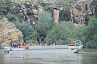
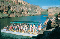
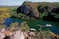
Katherine Gorge - Nitmiluk National Park
This 292,800 hectare National Park is owned by the
Jawoyn Aboriginal people and jointly managed with the
Parks and Wildlife Commission of the Northern Territory.
Some of the Park's features include spectacular dissected
sandstone country, broad valleys and numerous, significant
cultural sites. The deep gorge carved through ancient
sandstone by the Katherine River is the central attraction
of the Park.
How to Get There
Nitmiluk National Park is located in the Top End of
Australia's Northern Territory. The Park has two main
points of visitor access. The Park's main entrance is
located 30 km northeast of Katherine via a sealed road.
Katherine is located 310 km south of Darwin along the
Stuart Highway. Leliyn (Edith Falls) on the western
side of the Park, is reached by turning off the Stuart
Highway 42km north of Katherine then following a sealed
road for a further 19km.
When to Visit
The most comfortable months to visit the Park are from
May to September. The wet season causes flooding of
the Katherine River and restrictions on some of the
activities available. The access road may be cut off
for short periods during peak flooding times.
Visitor Facilities
The picnic area provides gas barbecues, picnic furniture
and toilet facilities. The launch tour boat jetty and
canoe hire are located adjacent to the boat ramp. A
public swimming area is provided in the picnic area.
Information on the flora, fauna, geology, walks, activities,
and other points of interest can be found in the Nitmiluk
Centre at Katherine Gorge.
Walking
Numerous walking tracks offer a variety of experiences
from riverbank strolls to spectacular overnight walks.
Overnight walkers are required to book and register
with Rangers at the Nitmiluk Centre.
Jawoyn art
Jawoyn art can be seen along the base of the sandstone
escarpment in the Gorge system. Other evidence of Jawoyn
activities are located throughout the Park. More detailed
information about the Southern Walks and the Jatbula
Trail is available in the Nitmiluk Centre, from Park
information sheets, on the website or by calling Rangers
at the Park.
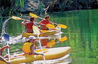
Canoeing
Canoes can be hired at the Gorge by the hour, half day,
full day or overnight. Private canoes can be used in
the Gorge. For your safety, you must register and pay
a refundable deposit at the Nitmiluk Visitor Centre.
A small fee also applies. The upper gorges are accessible
to canoes, by carrying them over the rocks separating
gorges.
Camping
There are powered sites at the Gorge or unpowered, sites
at Leliyn (Edith Falls). Campsite bookings are required
for overnight canoeing and camping as numbers are restricted.
A deposit applies to private canoes and bushcamping.
Check at the Nitmiluk Centre for the availability of
drinking water and location of toilets. Only fuel stoves
are permitted.
Fact Sheet Download
Park fact sheet (pdf
818Kb)
Leliyn (Edith Falls) fact sheet (pdf 685Kb)
Jatbula Trail Information Sheet (pdf 1070Kb)
Southern Walks Information Sheet (pdf 800Kb)
Baruwei Walks Information Sheet (pdf 675Kb)
This external link to the NT Government has changed
so we now just offer the NT Gov landing page link.
|
 |
 |
 |
 |
|
|
|
|
Katherine
 Sweeping
from the Gulf of Carpentaria to the West Australian
border, the vast Katherine region is full of hidden
gems. Sweeping
from the Gulf of Carpentaria to the West Australian
border, the vast Katherine region is full of hidden
gems.
Often called the 'Crossroads of the North' because
of its location, Katherine is the fourth largest town
in the Northern Territory and is located 312 km south-east
of Darwin on the Katherine River.
With a population of over 9,804 people Katherine is
a modern thriving regional center that offers a wide
range of services to communities from the Western Australian
border to the Gulf of Carpentaria on the Queensland
border.
There is a modern air conditioned shopping centre,
hospital, sports grounds, parks and gardens as well
as a large number of Commonwealth and Territory Government
services.
 Its
diverse landscapes and unique ecosystems set the scene
for outback adventure activities like fishing, canoeing,
bushwalking, birdwatching, camping and four-wheel driving. Its
diverse landscapes and unique ecosystems set the scene
for outback adventure activities like fishing, canoeing,
bushwalking, birdwatching, camping and four-wheel driving.
 The
outback meets the tropics at Katherine, about 300 kilometers
south of Darwin. The township is situated on the banks
of the Katherine River, which flows down from the world-renowned
Katherine Gorge (Nitmiluk National Park). The
outback meets the tropics at Katherine, about 300 kilometers
south of Darwin. The township is situated on the banks
of the Katherine River, which flows down from the world-renowned
Katherine Gorge (Nitmiluk National Park).
 Day
trips from Katherine can be taken north to Pine Creek
or south to Mataranka. Pine Creek has a strong gold
mining heritage, with original buildings dating back
to the 1800s, while Mataranka is famous for its tropical
thermal pool and nearby Elsey National Park. Day
trips from Katherine can be taken north to Pine Creek
or south to Mataranka. Pine Creek has a strong gold
mining heritage, with original buildings dating back
to the 1800s, while Mataranka is famous for its tropical
thermal pool and nearby Elsey National Park.
The Victoria River region, south west of Katherine,
is well known as a premier fishing holiday destination.
There are also excellent four-wheel drive tracks and
camping spots.
 Further
north, the Daly River region is another spot popular
for fishing and camping travellers with hot springs,
gorges and rivers. Further
north, the Daly River region is another spot popular
for fishing and camping travellers with hot springs,
gorges and rivers.
The remote Gulf region, east of Katherine, is perfect
for adventurous anglers who enjoy fishing in remote
rivers.
Katherine town council: http://www.ktc.nt.gov.au/
|
|
|
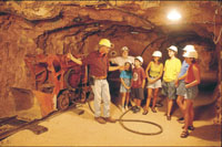
Cutta Cutta Caves Nature Park
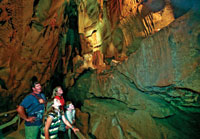 Cutta
Cutta Caves Nature Park covers 1,499 hectares of limestone
(Karst) landscape, which is limited to only a few locations
in Northern Australia. Cutta
Cutta Caves Nature Park covers 1,499 hectares of limestone
(Karst) landscape, which is limited to only a few locations
in Northern Australia.
Spectacular features such as Karst formations and
complex cave networks are a feature of the Park. Tower-like
masses of Tindal limestone with some supporting large
boulders and various surface depressions are other features
of this landscape.
How to Get There
Access is via the Stuart Highway 30 km south of Katherine.
The carpark and visitor centre are one km from the Highway
along a sealed road.
When to Visit
The park is open daily all year, however during the
Wet Season (December to April) the caves may be closed
due to flooding. The most comfortable time to visit
the park is between May and August.
What to See and Do
The park concession conducts daily guided tours, generally
conducted on the hour, of the cave system. The Tropical
Woodland walk begins near the carpark and enables visitors
to experience the open tropical woodland. Allow 10 to
20 minutes to complete the walk.
Visitor Facilities
A small kiosk sells tour tickets, refreshments
and souvenirs. Toilets and covered seating are provided.
Other facilities and features within the Park
include:
Caravans Permitted Kiosk Picnic Tables Walking Tracks
Fact Sheet: http://www.nt.gov.au/
|
|
|
Springvale Homestead Tourist Park
 Situated
7kms from Katherine township on the banks of the Katherine
River, Springvale Homestead was built in the 1880s
and is the oldest standing Homestead in the Northern
Territory. It is renowned for its hospitality and relaxed
atmosphere. Springvale Homestead offers travellers a
shady parkland environment, featuring grassed caravan
and camping sites, budget motel accommodation, a licensed
bistro and kiosk, swimming pool and childrens waterslide.
Relax, wander the picturesque grounds with wallabies
roaming freely and take in the beauty of the original
Homestead. Free Homestead Tours operate daily at 3:00pm
from May to September except Saturday and public holidays.
Learn about the history and enjoy a devonshire tea. Situated
7kms from Katherine township on the banks of the Katherine
River, Springvale Homestead was built in the 1880s
and is the oldest standing Homestead in the Northern
Territory. It is renowned for its hospitality and relaxed
atmosphere. Springvale Homestead offers travellers a
shady parkland environment, featuring grassed caravan
and camping sites, budget motel accommodation, a licensed
bistro and kiosk, swimming pool and childrens waterslide.
Relax, wander the picturesque grounds with wallabies
roaming freely and take in the beauty of the original
Homestead. Free Homestead Tours operate daily at 3:00pm
from May to September except Saturday and public holidays.
Learn about the history and enjoy a devonshire tea.
Accommodation types
Motel
Caravan/Camping
Camping Ground
Caravan Park
Property facilities
Bar BBQ Facilities Camp Kitchen Car park Courtesy
transfer Gas Ice Iron Kiosk Laundry Swimming
Pool Outdoor Restaurant - Licensed Tour Desk
Springvale Homestead
Address: Shadforth Road Katherine NT 0850
Email: springvalehomestead@bigpond.com
Telephone: +61 (0) 8 8972 1355
Fax: +61 (0) 88972 3201
|
|
|
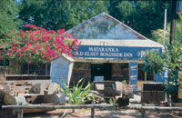
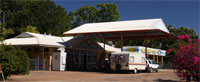
Mataranka
The small township of Mataranka sits on the upper reaches
of the Roper River, an hours drive south-east of Katherine.
This tropical wayside stop is on the Explorers Way
tourism drive, the main artery that connects Adelaide
and Darwin, and is renowned for its thermal pool a
sandy-bottomed lagoon fringed by palm forest and a rejuvenating
swimming spot for weary travellers up and down the
track.
Although the township itself is small, with a population
of about 250, it services outlying cattle stations and
Aboriginal communities so is well equipped with facilities
for travellers.
Parks & Wildlife Commission of the Northern
Territory
Mataranka Office Head Office
32 Giles St KATHERINE NT 0851
Ph: +61 (0) 8 8975 4560
Fax: +61 (0) 8 8975 4696
Map: http://www.nt.gov.au/
Theres a good range of camping grounds, accommodation
and a supermarket.
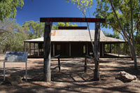
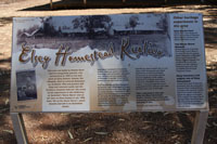
The area was made famous by Jeannie Gunns 1908 novel
'We of the Never Never' a book she wrote about nearby
Elsey Station that is now part of Australian folklore.
The Elsey Cemetery, 21 kilometers south of the township,
marks the final resting place of many of the books
characters.
Attractions around town include the Stockyard Gallery
that exhibits local Aboriginal art, barramundi hand-feeding
tours and the Never Never Museum that displays the local
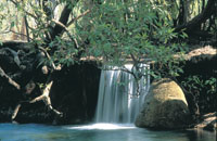
Aboriginal history. Elsey National Park, eight kilometers
from Mataranka, is another of the regions natural attractions.
The massive Roper River slices through this 140 square-kilometre
expanse, flowing through large waterholes then tumbling
over rocks and tufa dams. Canoeing and fishing are popular
activities and swimming is great at Bitter Springs and
the Thermal Pool. Scenic riverside walking tracks to
Mataranka Falls are a great way to explore the Park
overland.
|
 |
 |
 |
|
|
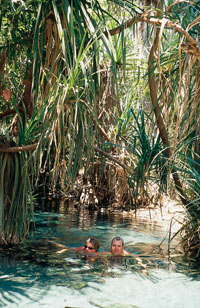
Mataranka Thermal Springs
Mataranka Thermal Pool
The Mataranka Pool is fed by spring water from the Daly
and Georgina basins at a volume of 30.5 million litres
per day.
It is surrounded by a palm forest and maintains a
constant temperature of 34 degrees, making it an ideal
place to relax, swim or camp overnight.
Mataranka Thermal Pool
The Mataranka Thermal pool is the biggest
draw card to the region. Nestled amongst tall shady
Mataranka Palms (Livistonia ....) the thermal pools
pump out a tremendous amount of warm water which has
soothed many a traveller over the years.
Only a stones throw from the Roper River, the turquoise
waters of the main pool add to the atmosphere of the
springs.
Before any walk ask at
Mataranka Cabins or Campground
http://www.matarankacabins.com.au/
Phone on 08 89754838 Email: enquiries@matarankacabins.com.au
Fax: 08 8975 4814.
Our reception is open from 8.00am to 7.00pm (CST) everyday
Botanic Walk
In Elsey National Park there are many great
walking trails . By far the easier ones are around the
Mataranka Thermal Pool (for those short on time), and
the other one is the Botanic Walk a few kilometers away
along the Roper River.
A great walking trail with informative displays and
a few seats & a table along the way. All very shady
for those worried about the temperature. At the turn
around point is the Roper River (in picture), from here
you can walk along the Roper River to 12 Mile Yards
(maybe 8 km further) The road & the track run along
the river with several other points of interest & entry/exit
points at smaller loop walks. So it is very easy to
be dropped off and walk for the day/morning back to
camp and only be less 1 km from the main road.
A great little swimming spot for kids is at the 4 mile
hole, where an offshoot of the main river sweeps around
creating a shady alleyway, that is segmented and shallow.
For the adventurous, get dropped off at the Botanic
walk and walk the 3.5 km to the 4 mile hole and meet
with others there (boat ramp). You get to see different
parts of the Waterhouse & Roper river .
Mataranka Falls
A pleasant 4 km walk along the Roper River and through
the bush from 12 Mile Hole (campgrounds). The tranquility
of the river turns to the roar of the water pouring
over the tufa dams (they act like your own spa pool).
The falls have changed dramatically over the years with
much of the established foliage ripped from the falls
during the wet season & more pandanus taking hold.
|
 |
 |
 |
|
|
Bitter Springs at Mataranka
Bitter Springs Mataranka NT When travelling through
Mataranka and you are looking for a nice relaxing place
to have a dip and actually stretch out and do some laps,
try Bitter Springs Thermal pool instead of the well
frequented Mataranka Thermal pools.
The springs here actually branch off into a stream
which you can follow down 100 metres to a bridge & ladder
to climb out of then go for a walk around the springs.
Consistently deeper than the Mataranka thermal pools,
Bitter Springs wasn't suited for very young children
(under 8's). But much quieter.
Take a floaty with you to paddle down to the 2 exit
points along the stream.
Map: http://www.nt.gov.au/
Bitter Springs is part of Elsey National Park and is
Mataranka's newest thermal pool. It has a day use area
with barbecues, tables and eco-friendly toilets. A walking
path loops around the area, winding under fan palms
(Livistona rigida), past the swimming pools and through
the pristine riparian ecology of the Roper River. To
the right the fan palms can be seen from a fish's point
of view, up through the clear waters of Bitter Springs
Thermal Pools. If you are not the adventurous type then
there is stairway entrance to the main pool where you
can just loll about soaking up the effects of the luxuriant
32 degrees Celsius spring water. There is another way
to experience Bitter Springs. Wade into the warm waters
of the Spring and drift with the flow down along the
stream that connects the two swimming areas and on to
the exit ladder at the pedestrian bridge on the walkway
that circles the Spring area.
This Aquatrail (a typical underwater view on right)
drifts a couple of hundred metres down through the Springs.
The water is incredibly clear, with an underwater mask,
freshwater turtles are often seen swimming amongst the
reed beds. At the end of the gentle drift, a ladder
lets the adventurer climb out onto the Bitter Springs
walking path and return to the main pool for another
go round. Swimming back up against the current is not
recommended.
Mataranka Cabins
http://www.matarankacabins.com.au/
Phone on 08 89754838 Email: enquiries@matarankacabins.com.au
Fax: 08 8975 4814.
Our reception is open from 8.00am to 7.00pm (CST) everyday
The cabins can sleep up to five people. Linen and towels
are included and the cabins are fully appointed with
television, microwave, stove, cooking utensils and a
large fridge - everything needed to make your home-away-from-home;
and we are just a short walk to Bitter Springs Thermal
Pools!
Caravan Park Campground
http://www.matarankacabins.com.au/
Phone on 08 89754838 Email: enquiries@matarankacabins.com.au
Fax: 08 8975 4814.
Our reception is open from 8.00am to 7.00pm (CST) everyday
Last Update: Unpowered campsites are
$21 pn and powered sites are $25pn for a double. Kids
over 2 y.o. are $5 pn each.
The layout of our caravan park is very informal, you
can choose your own spot. Stay hitched up to your caravan
if you want. Campfires are allowed in the riverside
unpowered campground and pets are welcome. Sorry, no
generators please! The Little Roper River borders our
park so our guests can camp right on its banks and enjoy
the natural bush setting. The Caravan Park has powered
sites with bore water on tap, toilets, showers, camp
kitchen and a laundry. There is plenty of space so you
wont be crammed in like sardines! Wallabies are abundant
and barramundi and other fish are caught in the river.
The rare Red Goshawk nests in this area and birdwatchers
are regular guests in the campgrounds and cabins. The
Bitter Springs Thermal Pools are a 500 metre walk or
short drive from Mataranka Cabins and Camping.
|
|
|
|
|
|
|
|
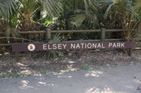
Elsey National Park
Elsey National Park, eight kilometers from Mataranka,
is another of the regions natural attractions. The
massive Roper River slices through this 140 square-kilometre
expanse, flowing through large waterholes then tumbling
over rocks and tufa dams.
Canoeing and fishing are popular activities and swimming
is great at Bitter Springs and the Thermal Pool. Scenic
riverside walking tracks to Mataranka Falls are a great
way to explore the Park overland.
The Rainbow Springs and Thermal Pool sector of the
Park are a major attraction for visitors. The spring
water rising from underground at 30.5 million litres
per day and at a temperature of 34 Degrees Celsius is
then contained in a relaxing swimming pool surrounded
by a palm forest.
How to get there
The Park has three access points. To access the main
Thermal Pool (Mataranka Hot Springs), take the Homestead
Road turnoff (1.5km south of Mataranka on the Stuart
Highway) and follow it for around 7km.
To access the facilities along John Hauser Drive,
turn off the Homestead Road around 4km from the Highway.
The Bitter Springs access is via a sealed road leading
directly from the Mataranka township.
Fact sheet: Elsey National Park and
map
http://www.nt.gov.au/
Visitor Facilities
Picnic areas complete with tables, wood barbecues and
toilet facilities are provided at Bitter Springs, 12
Mile Yards, Mulurark and 4 Mile.
There are also camping areas provided.
Please Remember - Elsey National Park
Avoid using soaps and detergent in or near the waterways.
Camp only in designated areas, and collect firewood
before arriving at your campsite.
Generators are not permitted in this park (Elsey National
Park).
Observe all fishing regulations.
Pets are not permitted in this Park.
Nets, traps and firearms are not permitted
Elsey Falls at Mataranka
Mataranka Northern Territory Only 100 km south of Katherine
A great place to see some free Barramundi feeding, where
the fish are pulled from the water with bare hands.
Have a relaxing swim in the many thermal pools and crystal
clear streams.
Walk along the many shady walking trails amongst the
massive palm trees. We have stayed here several times
so far during 2003 - 2009 as we poke around in different
parts of the region.
Next time we will be off to the 12 mile yards to camp
and walk along the Roper River to Mataranka falls, after
walking and enjoying the 1 hour "Botanic Walk" .
Old Elsey Cemetery
The Old Elsey Cemetery, 21 kilometers from Mataranka,
has graves dating back to 1926. Its a significant part
of Australia's heritage and is the final resting place
of many local characters written about in the famous
1908 novel 'We of the Never Never' by Jeannie Gunn.
Mataranka Cabins and Camping
4705 Martin Road, Bitter Springs, Mataranka
PO Box 4071 Mataranka, NT 0852
GPS Co-ordinates: South 14 54 65 East
133 05 01
NT Govt. site: http://www.nt.gov.au/nreta/parks/find/elsey.html
Parks & Wildlife Commission of the Northern
Territory
Mataranka Office Head Office
32 Giles St Katherine NT 0851
Ph: +61 (0) 8 8975 4560
Fax: +61 (0) 8 8975 4696
|
|
 |
 |
 |
 |
|
|
Stuart Highway- Explorers Way from Adelaide
to Darwin
Drive the Explorer's Way Follow the same route
of famous Australian explorer John McDouall Stuart and
travel through red desert country via the real Australian
outback en route to the Territorys lush northern tropics.
This road links the Territory from top to bottom,
encompassing some of its best-known natural icons; the
Devils Marbles, Litchfield National Park, Nitmiluk National
Park, Cutta Cutta Caves and Bitter Springs. In the south,
the road is straddled by the East and West MacDonnell
Ranges.
You can get a snapshot of the Territory in 7 days,
but with so much to explore, its easy to stay much
longer. http://en.travelnt.com/
|
|
|
|
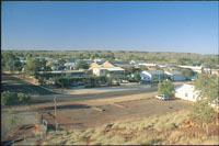
Larrimah
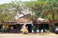 In
open tropical woodlands 75 kilometers south of Mataranka,
Larrimah is a former railway town good for a stopover. In
open tropical woodlands 75 kilometers south of Mataranka,
Larrimah is a former railway town good for a stopover.
The town consists of three main establishments which
provide a good variety of accommodation and services,
and the nearby ghost town of Birdum is fun to explore.
 The
historic township of Larrimah, located 250 kilometers
south of Katherine, is a pleasant stop along the Stuart
Highway. Its traditional owners are the Yangman Aboriginal
people, whose descendants live today in the nearby community
of Wubuluwan and in other communities around the region.
The Yangaman people believe Dreaming tracks of the Storm
Bird (a Channel Bill Cuckoo) helped create the surrounding
landscape. The
historic township of Larrimah, located 250 kilometers
south of Katherine, is a pleasant stop along the Stuart
Highway. Its traditional owners are the Yangman Aboriginal
people, whose descendants live today in the nearby community
of Wubuluwan and in other communities around the region.
The Yangaman people believe Dreaming tracks of the Storm
Bird (a Channel Bill Cuckoo) helped create the surrounding
landscape.
 Originally
a staging camp for more than 3,000 servicemen during
the Second World War, Larrimah is one of the Territorys
most historic towns with a memorabilia display at the
old Police Station. Dont pass up one of Frans famous
home made pies, you cant miss the signs. Originally
a staging camp for more than 3,000 servicemen during
the Second World War, Larrimah is one of the Territorys
most historic towns with a memorabilia display at the
old Police Station. Dont pass up one of Frans famous
home made pies, you cant miss the signs.
 Camping
and Accommodation: Camping
and Accommodation:
Shell Roadhouse Caravan Park - Larrimah
Malhoney St - Stuart Hwy, Larrimah, NT, 0852
Tel: +61 (0) 8 8975 9932 or 31
Email: la.pub@bigpond.com.au
http://www.barklytourism.com.au/
Last Update: 5 cabins 40 sites
|
|
Daly Waters
Daly Waters can be found about 270 kms south of Katherine,
close to the junction of the Carpentaria and the Stuart
Highway. Daly Waters Pub is on the Stuart Highway actually
near the intersection of Stuart Highway and Carpentaria
Highway. A township which comprises a few houses and
the very famous Daly Waters Hotel.
The annual Daly Waters Rodeo is a Northern Territory
local icon event.
Daly Waters also has the distinction of being Australia's
first international airfield. It has a unique
aviation history. It was a centre location for the London
to Sydney air race of 1926, also World War II air force
base and a refuelling stop for Qantas.
The Daly Waters WW11 Aerodrome and Hangar (Aircraft)
exhibits interesting pieces of historical facts, photographs
and old equipment from the immediate areas former glory
aviation days.
The area's traditional Aboriginal owners, the Jingili
people, believe the Dreaming tracks of the Emu and the
Sun travelled through here on their way to the southern
parts of the Northern Territory.
When the famous Australian explorer John McDouall
Stuart explored the areas of Daly Waters in the late
1800s he and his party became lost in the region and
were dissolute and desperate for drinking water, making
their discovery of a small creek leading to a series
of waterholes particularly significant.
|
 |
 |
 |
|
| |
|
Carpentaria Highway turnoff
south of Daly Waters
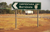 You'll
pass the turn off about 150km east of the Stuart Highway.
Now we're off on the longest driveway in the world,
nearly 400km to "the 'Loo". You'll
pass the turn off about 150km east of the Stuart Highway.
Now we're off on the longest driveway in the world,
nearly 400km to "the 'Loo".
It's a long but pleasant drive if you don't push too
hard; there are parking bays every 30 or 40km and several
rest areas, suitable for camping, along the way to "Heartbreak"
and on to" the "Loo". There are lots of just natural
things to take your interest; the jump up - or down
in this direction - at around the 250km mark is spectacular,
especially if you're there at sunrise, and we intend
to prepare a strip map from Burketown to Daly Waters
in the near future.
Isolated Limmen National Park offers a wonderful remote
park experience, but you will need to be fully self-reliant
when you visit. Featuring spectacular sandstone formations,
numerous river systems and associated wetlands, it is
also steeped in culture and history.
Daly Waters Hi-Way Inn
 Daly
Waters Hi-Way Inn & Caravan Park Daly
Waters Hi-Way Inn & Caravan Park
Cnr. Stuart & Carpentaria Hwys Daly Waters NT 0852 Tel:
+61 (0) 8 8975 9925.
Located on the corner of the Stuart and Carpentaria
Highways, the Daly Waters Hi Way Inn offers a variety
of accommodation options from motel rooms through to
camping sites. Enjoy the wide range of facilities available,
including a licensed restaurant and bar, swimming pool,
internet cafe and barbecues. With rooms serviced daily
and great hospitality, you'll be able to unwind and
relax, before planning your next Territory adventure.
Budget Room
The budget rooms have double beds and bunks, with toilet
and showers amenities close by.
Deluxe Room
The deluxe room contains a queen size bed and a sofa
bed, and has a verandah with tables and chairs.
Powered Site
There are a range of powered sites available, with ablution
blocks, barbecues and swimming pool close by. Indicative
rate quoted is per person per night.
Standard Room
The standard room contains a double bed, and bunks or
single beds, and has a large verandah with tables and
chairs.
Unpowered Site
There is a range of unpowered sites available, all within
easy access of ablution blocks, barbecues and swimming
pool. Indicative rate quoted is per person per night.
Dunmurra
 Dunmarra
is a roadhouse 314 km south of Katherine on the Stuart
Highway. Caravan park with lawned sites, large swimming
pool and new amenities with budget air conditioned Motel
accommodation, fuel and autogas. Dunmarra
is a roadhouse 314 km south of Katherine on the Stuart
Highway. Caravan park with lawned sites, large swimming
pool and new amenities with budget air conditioned Motel
accommodation, fuel and autogas.
Take away food, restuarant, EFTPOS, Shellcard. With
lots of pubobilia at the Bar and a wall size painted
camp scene in the bar area of the public pub. "Banjo's
Dream", hand painted mural showing the location of Dunmarra
in the NT.
Address: Stuart Hwy Dunmarra Northern
Territory 0852
Tel:+61 (0) 8 8975 9922
Newcastle Waters
 Located
at the junction of three major overland stock routes,
Newcastle Waters was an important gathering place for
drovers to provision and rest before continuing on with
their gruelling overland cattle drives. The Newcastle
Waters township, located 269 kilometers north of Tennant
Creek, is part of a large, historic cattle station in
the Barkly Tablelands. Located
at the junction of three major overland stock routes,
Newcastle Waters was an important gathering place for
drovers to provision and rest before continuing on with
their gruelling overland cattle drives. The Newcastle
Waters township, located 269 kilometers north of Tennant
Creek, is part of a large, historic cattle station in
the Barkly Tablelands.
 The
township has become a ghost town, but while uninhabited,
Newcastle Waters has a rich, vibrant history. Preserved
historic buildings such as Jones's Store and the Junction
Hotel are a reminder of the early pioneering era. The
township has become a ghost town, but while uninhabited,
Newcastle Waters has a rich, vibrant history. Preserved
historic buildings such as Jones's Store and the Junction
Hotel are a reminder of the early pioneering era.
Newcastle Waters was once the drover's crossing point
where stock routes from the east and south met. It was
also departure point for the feared Murranji Track,
a notorious stock route with long stages between water
for cattle. A number of old buildings from the droving
days remain and are well marked with interpretive plaques.
 The
small township grew until the Junction Hotel served
its last beer in 1960 and the remaining buildings are
a testament to the era. The remains of the pub, the
museum. More information on Newcastle Waters at Barkly
Tourism The
small township grew until the Junction Hotel served
its last beer in 1960 and the remaining buildings are
a testament to the era. The remains of the pub, the
museum. More information on Newcastle Waters at Barkly
Tourism
The famous Junction Hotel/Store & the Drovers Memorial
statue dedicated during the Last Great Cattle Drive
in 1988. Its set in the middle of a working station
and well worth a visit. The Drover's Memorial Park features
a large bronze statue of a drover allowing passers by
to step back in time and gain insight into life in the
rugged and lonely Northern Territory outback. Visitors
access is through Newcastle Waters Station.
Please observe all station rules that apply.
Newcastle Waters Station
Newcastle Waters is a magnificent 10,353 sq km breeding
property in the west Barkly region of the Northern Territory.
Its open plains, flood country and timbered sand hills
carry 45,000 head of cattle including 20,000 commercial
Brahman breeders. The historic property is also home
to Newcastle Waters Brahman stud, which comprises 2,600
stud females including 20 single sire herds. The stud
produces quality, acclimatised herd bulls for CPC's
northern properties. http://www.pastoral.com/newcastle.html
The famed explorer John McDouall Stuart (See
his memorial just below) passed thru this area during
1861 reputedly describing the river running north from
Lake Woods as the most splendid reach of water?. He
reputedly named it after the Duke of Newcastle, Secretary
for the Colonies. Stuart established a base camp near
the present site of the station.
Elliott - BP Fuels
 255
kilometers north of Tennant Creek and 23 km to the south
of Newcastle Waters is the small town of Elliott. or
100kms south of Dunmarra and 85kms north of renner Springs. 255
kilometers north of Tennant Creek and 23 km to the south
of Newcastle Waters is the small town of Elliott. or
100kms south of Dunmarra and 85kms north of renner Springs.
Open 7am to 5pm 7 days a week.
Elliott is the Barkly regions second largest town
and was developed during World War II. There is a range
of services and facilities available for the traveller.
Lake Woods nearby is a large body of permanent water
in an otherwise largely arid region and is a haven for
many bird species.
Midland Caravan Park
102 Stuart Hwy Elliott NT 0862.
Tel: +61 (0) 8 8969 2037
Spacious park with modern clean amenities, Cabins, powered
and unpowered sites. Takeaway food.
Fuel
General Store
Cold Drinks
Post office
EFTPOS
|
|
|
Renner Springs
Renner Springs, now a roadhouse and motel, was originally
a medical post for the workers constructing the Overland
Telegraph Line in the 1870s. Its name derives from Doctor
Charles Renner, who was the physician there, and the
fact that there are numerous springs in the area.
Renner Springs takes pride in the level of service
and quality of product it delivers, and clientele can
be assured of a memorable experience of hospitality,
and "a little bit of desert magic" whenever they visit.
Renner Springs Desert Inn
27 Air-Conditioned Rooms Powered Caravan Sites - Shady
Campground
Licenced Restaurant - Lounge and Public Bar -
Take Away Food Homestyle Cooking -
Shop and Souvenirs
Homebaked Bread Barbeque Area -
Games Area
ULP - Lead Replacement - Diesel - LPG - LPG Bottle
Refill Station
Renner Springs Roadhouse Stuart Highway, Northern Territory
CMB 7, Renner Springs NT 0862 Reception open 6.30am
- 11.00pm
Tel: +61 (0) 8 8964 4505
Fax: +61 (0) 8 8964 4525
Email: rennersprings@bigpond.com
http://www.rennerspringshotel.com.au/
|
|
|
|
|
|
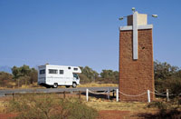
 Stuart
Memorial Stuart Highway Northern Territory Stuart
Memorial Stuart Highway Northern Territory
Today, his name is perpetuated by: The Stuart Highway
linking Adelaide to Darwin
Explorer: The Overland Telegraph Line, linking Adelaide
to Europe via Darwin, was constructed along his route.
South Australia established settlement on the north
coast at Darwin and vast areas of the north were opened
up for pastoral and mineral development.
 John
Flynn Memorial John
Flynn Memorial
Flynn's work is perpetuated throughout the outback
in many ways. The Royal Flying Doctor Service and the
Australian Inland Mission are working testimonials to
his drive and vision. In 1956 the Flynn Memorial Church
was dedicated in Alice Springs; at Threeways, north
of Tennant Creek a massive monument marks the junction
of the Barkly Highway from Queensland and the Stuart
Highway to Darwin, it is called the Flynn Memorial.
Source: http://www.wilmap.com.au/
|
|
|
Three Ways Roadhouse, Stuart Highway Northern
Territory
 Travelling
north from Tennant Creek towards Katherine on the fast,
straight Explorers Way, you pass through golden grasslands
that slowly give way to Savannah woodland. Along the
way, reminders of the past abound from the regions
pioneering, pastoral and Second World War history. Travelling
north from Tennant Creek towards Katherine on the fast,
straight Explorers Way, you pass through golden grasslands
that slowly give way to Savannah woodland. Along the
way, reminders of the past abound from the regions
pioneering, pastoral and Second World War history.
Three Ways is a roadhouse located at the junction of
the Stuart and Barkly Highways, 25 kilometers north
of Tennant Creek. This a great place to take a break
and unwind during a long journey, all while enjoying
warm Northern Territory hospitality.
 A
local point of interest is the Flynn Memorial. Reverend
John Flynn pioneered the Royal Australian Flying Doctors
Service. The memorial originally sat at the exact meeting
spot of the Barkly and Stuart Highways, but the point
has now been moved 250 metres south. The Three Ways
Roadhouse offers restaurant meals, take away food, refreshments A
local point of interest is the Flynn Memorial. Reverend
John Flynn pioneered the Royal Australian Flying Doctors
Service. The memorial originally sat at the exact meeting
spot of the Barkly and Stuart Highways, but the point
has now been moved 250 metres south. The Three Ways
Roadhouse offers restaurant meals, take away food, refreshments
The Three Ways Roadhouse offers restaurant meals, take
away food, refreshments and fuel. It has a landscaped
caravan park with barbecues, a swimming pool, and air-conditioned
motel units and cabins.
Shell Threeways Roadhouse
Stuart Hwy (Cnr Barkley Hwy) Tennant Creek NT 0860 Tel:
+61 (0) 8 8962 2744
www.threewaysroadhouse.com.au
(Site not active last check)
|
|
|
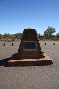
Bridge over Attack Creek north of Three Ways
 4
kilometers north of Tennant Creek is a monument marking
the point where explorer John McDouall Stuart turned
back on his expedition to cross the continent in 1860
after a hostile encounter with some local Aboriginal
people. It has since been appropriately known as Attack
Creek. 4
kilometers north of Tennant Creek is a monument marking
the point where explorer John McDouall Stuart turned
back on his expedition to cross the continent in 1860
after a hostile encounter with some local Aboriginal
people. It has since been appropriately known as Attack
Creek.
|
|
|
Tennant Creek Stuart Highway Northern Territory
 Tennant
Creek in Central Australia sits on the Explorers Way,
500 kilometers north of Alice Springs and 1000 kilometers
south of Darwin. Tennant
Creek in Central Australia sits on the Explorers Way,
500 kilometers north of Alice Springs and 1000 kilometers
south of Darwin.
To the east of town is the Barkly Tablelands - an expanse
of land that supports some of Australias premier outback
cattle stations.
 Tennant
Creeks history is shaped by gold mining, Aboriginal
culture and pastoralism. The region's rich mining history
can be explored at Battery Hill Mining Centre, the site
of Australia's last major gold rush in the 1930s. Visitors
can even try fossicking for their own gold. Tennant
Creeks history is shaped by gold mining, Aboriginal
culture and pastoralism. The region's rich mining history
can be explored at Battery Hill Mining Centre, the site
of Australia's last major gold rush in the 1930s. Visitors
can even try fossicking for their own gold.
Aboriginal culture is strong in Tennant Creek. The
award-winning Nyinkka Nyunyu Art and Culture Centre
offers visitors the opportunity to learn about Aboriginal
life, history and land. The mysterious rock spheres
of nearby Karlu Karlu (Devils Marbles) are said to be
the eggs of the Rainbow Serpent - a creature of a Dreamtime
story.
Adventure lovers have plenty of options in the Tennant
Creek area. Four-wheel-drivers in particular are spoilt
for choice with moderate to challenging four-wheel drive
tracks available to test skills and vehicles. Stop at
character-filled outback pubs, explore the historic
Overland Telegraph Line, or experience star-filled nights
in a swag. http://en.travelnt.com/
 ennant
Creek Caravan Park ennant
Creek Caravan Park
208 Paterson Street off Stuart Highway, Tennant
Creek
Tel: +61 (0) 8 8962 2325
Tennant Creek Caravan Park is an ideal base for exploring
the area. We're located on the stuart highway only a
5 minute walk to the shops with good access to Tennant
Creek main and a good pick up point for tours.
The park is a beautifully landscaped 2 hectare site
offering open and shady spaces and a good standard of
facilities including our outdoor swimming pool; a perfect
way to relax after a hot days touring. A range of accomodation
options are available to suit all tastes and budgets.
We offer grassy lawns for camping, powered or unpowered
caravan sites, bunk houses, standard and en-suite cabins.
Other facilities:
Camp kitchen Gas BBQ Ice Souvenirs
Tennant Creek - Mary Anne Dam
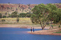 Mary
Ann Dam Recreation Lake is a cool oasis, five kilometers
north of Tennant Creek. This man made dam is a pleasant
surprise in a rugged, Central Australian environment,
offering an ideal picnic spot where the lake provide
a cool oasis for locals and tourists alike and is large
enough to allow for canoeing, windsurfing and other
water sports. Mary
Ann Dam Recreation Lake is a cool oasis, five kilometers
north of Tennant Creek. This man made dam is a pleasant
surprise in a rugged, Central Australian environment,
offering an ideal picnic spot where the lake provide
a cool oasis for locals and tourists alike and is large
enough to allow for canoeing, windsurfing and other
water sports.
|
|
| |
|
Karlu Karlu / Devils Marbles Conservation Reserve
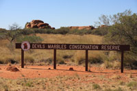 Free
entry Free
entry
(Aboriginal Culture) (Aboriginal Self Discovery)
The Karlu Karlu / Devils Marbles are clusters of mysterious
rock spheres located in the scenic Australian desert
near the outback town of Tennant Creek, scattered in
heaps throughout a wide, shallow valley.
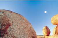 The
boulders, which are often precariously balanced on top
of one another, were formed by millions of years of
erosion. The local Aboriginal people, the Warumungu,
believe that the boulders are the eggs of the Rainbow
Serpent. The
boulders, which are often precariously balanced on top
of one another, were formed by millions of years of
erosion. The local Aboriginal people, the Warumungu,
believe that the boulders are the eggs of the Rainbow
Serpent.
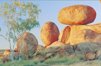 The ancient Aboriginal mythology surrounding this fascinating
geological marvel can be explored through a short self-guided
walking trail and informative signage.
The ancient Aboriginal mythology surrounding this fascinating
geological marvel can be explored through a short self-guided
walking trail and informative signage.
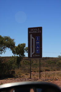 he
Karlu Karlu / Devils Marbles Conservation Reserve, stretching
over 1,802 hectares, is home to a wide variety of unique
desert flora and fauna, including goannas and finches. he
Karlu Karlu / Devils Marbles Conservation Reserve, stretching
over 1,802 hectares, is home to a wide variety of unique
desert flora and fauna, including goannas and finches.
The reserve is located approximately 400 kilometers
north of Alice Springs or 100 kilometers south of Tennant
Creek.
The nearest town, Wauchope, offers a limited range
of accommodation and facilities.
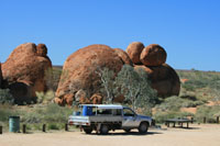 Camping
is permitted within the Reserve (fees apply), offering
a great way to enjoy this ancient landscape. One of
the best times to explore or photograph these unique
formations is at sunrise and at sunset. Camping
is permitted within the Reserve (fees apply), offering
a great way to enjoy this ancient landscape. One of
the best times to explore or photograph these unique
formations is at sunrise and at sunset.
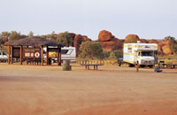 Facilities: Facilities:
BBQ Facilities
Car park
Picnic Area
Public Toilet
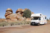 How
to Get There How
to Get There
This 1,802 hectare Reserve extends along both sides
of the Stuart Highway approximately 393 km north of
Alice Springs. The nearest settlement is Wauchope, 9km
to the south, where fuel and limited stores can be obtained.
 When
to Visit When
to Visit
Access is available all year round.
What to See and Do
An easy short (15 minutes return) self guided walk commences
from the carpark on the western side of the road (the
day use area) with signs explaining the formation of
the 'marbles'. Visitors can wander around the site along
a network of informal walking tracks.
Visitor Facilities
A simple bush camping area with fire places and pit
toilets is located at the southern end of the Reserve.
No water or firewood is provided, and campers should
come well equipped.
Camping
A simple bush camping area with fire places and pit
toilets is located at the southern end of the Reserve.
No water or firewood is provided and you should therefore
bring your own supplies. Camp only in designated camping
areas and camping fees are payable onsite.
Maps and Fact Sheet: http://www.nt.gov.au/
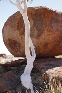
|
|
|
Wauchope Hotel and Roadhouse
Address: Stuart Highway Wauchope Northern
Territory 0862 Australia
Tel: +61 (8) 8964 1963
Fax +61 (8) 8964 1567
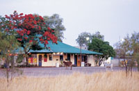 This
historic pub dates back to the 1930s, when Wolfram was
mined nearby. Today Wauchope Hotel provides comfortable
cabins or caravan park accommodation, food and refreshments
for travellers who want to experience the hospitality
for which the outback is famous. Wauchope Hotel and
Roadhouse is also the closest accommodation to the Karlu
Karlu / Devils Marbles. This
historic pub dates back to the 1930s, when Wolfram was
mined nearby. Today Wauchope Hotel provides comfortable
cabins or caravan park accommodation, food and refreshments
for travellers who want to experience the hospitality
for which the outback is famous. Wauchope Hotel and
Roadhouse is also the closest accommodation to the Karlu
Karlu / Devils Marbles.
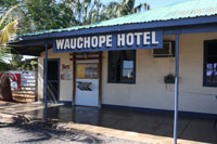 Accommodation
types Accommodation
types
Hotel Caravan/Camping
Camping Ground
Caravan Park
Property facilities
Bar BBQ Facilities Bicycle Hire Car park Cafe/Coffee
shop Fuel Ice Iron Swimming Pool Outdoor Restaurant
- Licensed Shop
Wycliffe Well
|
|
|
Wycliffe Well Holiday Park
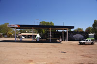 Wycliffe
Well is an oasis in the desert, and Australias UFO
hot spot. Wycliffe Well is located 380 kilometers north
of Alice Springs on the Stuart Highway, perfectly situated
as a stop over. Wycliffe Well Holiday Park occupies
a land area of approximately 60 acres, housing onsite
accommodation options, grassed unpowered spaces and
powered sites. Wycliffe
Well is an oasis in the desert, and Australias UFO
hot spot. Wycliffe Well is located 380 kilometers north
of Alice Springs on the Stuart Highway, perfectly situated
as a stop over. Wycliffe Well Holiday Park occupies
a land area of approximately 60 acres, housing onsite
accommodation options, grassed unpowered spaces and
powered sites.
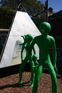 The
park is only a few minutes drive to one of the Northern
Territorys most renowned attractions, the Karlu Karlu
/ Devils Marbles Conservation Reserve. There is also
an auditorium, bar, animal sanctuary, a large fishing/crabbing
lake, restaurant and stage with an Aboriginal performance
theme. Wycliffe Well is also home to one of the largest
range of beers in Australia. The
park is only a few minutes drive to one of the Northern
Territorys most renowned attractions, the Karlu Karlu
/ Devils Marbles Conservation Reserve. There is also
an auditorium, bar, animal sanctuary, a large fishing/crabbing
lake, restaurant and stage with an Aboriginal performance
theme. Wycliffe Well is also home to one of the largest
range of beers in Australia.
Accommodation types
Cabin Self Contained Caravan/Camping Camping
Ground Caravan Park On-site Van
Property facilities
Bar BBQ Facilities Camp Kitchen Car park Cafe/Coffee
shop Fuel Games/Recreation Room Gas Ice Laundry
Non Smoking Floor Swimming Pool - Indoor Public
Telephone Restaurant - Licensed Security System Shop
|
|
|
Banka Banka Station Stuart Highway Northern
Territory
Banka Banka Station was the first operational cattle
lease in this region and also served as an army camp
during World War II.
Visitors can camp overnight at the station and learn
about its past.
The mudbrick Banka Banka homestead is situated approximately
100km north of Tennant Creek and about 100m west of
the Stuart Highway on Banka Banka Station.
|
 |
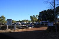 |
|
|
Barrow Creek Hotel
Address Stuart Highway Barrow Creek Northern
Territory 0872Telephone +61 (8) 8956 9753
Fax +61 (8) 8956 9845
The Barrow Creek Hotel is on the road between Alice
Springs and Tennant Creek and is a popular stop for
travellers along the highway.
The old pub was built in 1926 and it still has the
original old bar, underground cellar and tin ceilings,
and contains a tremendous collection of memorabilia
and items of interest which have been gathered over
the years.
It is worth stopping at the Barrow Creek Hotel to enjoy
the publican's hospitality and to hear how Barrow Creek
came to be an important outpost on the Overland Telegraph
line. There's demountable accommodation outside, rooms
inside and a caravan park.
Powered Sites
These sites are suitable for caravans and close to
amenities.
Room Facilities:
Shared bathroom
Property facilities:
Bar BBQ Facilities Car park Cots Available Fuel
Ice Iron Kiosk Medical Facilities Foreign Currency
Exchange
|
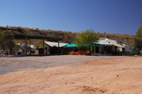 |
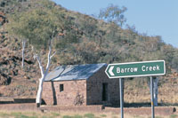 |
|
|
Barrow Creek
Barrow Creek Telegraph Station Free entry A beautifully
restored Barrow Creek Telegraph Station is located in
Barrow Creek, set against the backdrop of the picturesque
Forster ranges.
This historical reserve is one of 15 telegraph stations
that formed the network from Port Augusta to Port Darwin
and has considerable historical value.
The stone buildings were originally constructed in
1872. An information sheet on the self guided walk is
available from the Parks and Wildlife website or the
Barrow Creek Pub.
Facilities Car park
Also situated there is the Teamtser-memorial
|
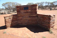 |
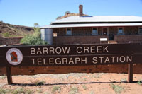 |
|
|
Ti Tree Roadhouse
Tel:+ 61 (0) 89569741
Is a town in the Northern Territory along the Stuart
Highway 193 km north of Alice Springs, 311 km south
of Tennant Creek & 1289 km south of Darwin in Australia.
It is the closest town to Alice Springs. The area around
Ti Tree has a population of 995 people.
The population is distributed between the 11 cattle
stations, 6 Aboriginal outstations including Utopia,
Ti Tree township, Barrow Creek community & the agricultural
produce farms of Ti Tree Farm, Central Australian Produce
Farm & the Territory Grape Farm.
The area is an emerging centre for grapes & melons
due to its year-round sunshine & abundant underground
water supply. A famous landmark to the north of Ti Tree
is Central Mount Stuart.
Property facilities:
Fuels, Autogas, Mini Mart, ATM, Counter and restuarant
meals, Fully Self contained Motel rooms.
Caravan Park and Grassed Camping
Clean amenities, Postal services and EFTPOS
|
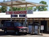 |
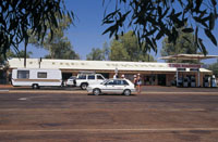 |
|
|
Aileron Roadhouse
PMB 175 via Alice Springs NT 0872 (135km north
of Alice)
Tel: +61 (0) 8 8956 9703 Fax: Tel: +61 (0) 88956 9868
Property facilities:
Outback hospitality, Aboriginal art gallery, accom:
camping, caravan grounds and air-con motel rooms, pool,
BBQ picnic area, take a walk and view beautiful scenery,
stop for fuel, buy some supplies at the store, or for
a longer break enjoy some breakfast, lunch or dinner
with an icy cold beer in the Glen Maggie bar!
|
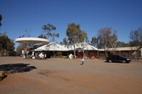 |
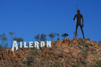 |
|
|
Plenty
Highway turn off
58Kms from Bond
Springs going north
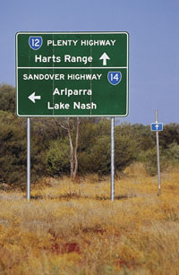 Travelling
from Alice Springs past the Bond Springs turnoff turn
off right to go onto the Plenty Highway and a further
27km to turn left up to the Sandover Highway. Travelling
from Alice Springs past the Bond Springs turnoff turn
off right to go onto the Plenty Highway and a further
27km to turn left up to the Sandover Highway.
Experience a taste of life on an Historic cattle station
in Australia's vast interior, yet be only 25kms from
Alice Springs, that famous town at the heart of the
legendary "Outback". Laura and Ben invite you to join
them on the Heaslip family's historic Bond Springs Station
a 1515 square km cattle grazing property nestled in
the picturesque, rugged MacDonnell Ranges.
Guests are offered a choice of two self contained comfortably
furnished cottages a short walk from the Station Homestead.
Corkwood Cottage (3 Bedrooms)
"The Wurlie" (2 Bedrooms)
Providing a Gold Award romantic retreat for two,
or A great family option Cottages are air-conditioned
and heated.
Gourmet Breakfasts delivered to your cottage
Transfers can be arranged
http://www.outbackretreat.com.au/
Tropic Of Capricorn Marker
 The
Tropic of Capricorn crosses the Stuart Highway 30 kilometers
north of town. There is a monument marking the spot
and a parking area. The
Tropic of Capricorn crosses the Stuart Highway 30 kilometers
north of town. There is a monument marking the spot
and a parking area.
The Tropic separates the tropic (to the north) and
temperate zones. It passes through Rockhampton on the
east coast of Queensland.
The Tropic of Capricorn Marker, a Bicentennial community
project, is set back 15 metres from the road, along
the Stuart Highway 30 kilometers north of Alice Springs.
In 1987 the local Alice Springs newspaper ran a competition
for a design to replace the Tropic of Capricorn marker.
The winning design was submitted by a local resident,
it consists of a stylised globe of the world on top
of a slanted pole around 6.5 metres high.
A local artist was commissioned to carve the Capricorn
goats into either side of the cement base and the new
marker was officially opened late 1988.
Facilities:
BBQ Facilities
|
|
|
Alice Springs Alice Springs - The
heart of Central Australia is comprised of cavernous
gorges, boundless desert landscapes, remote Aboriginal
communities and a charming pioneering history. Alice
Springs was established by the early explorers and remains
as the centre of activity in this region.
From the early 1900s, the vast desert of Central Australia
was explored for its promise of rubies and gold. Today,
north of Alice Springs is an adventure travel destination
where visitors can still fossick for gems and explore
the Australian desert while trekking, camping or four-wheel
driving.
Year round blue skies, stunning landscapes and a vibrant,
diverse community - that's Alice Springs!
Only a two hour flight from most Australian cities,
Alice Springs is a must see destination renowned for
its unique identity and rich cultural heritage.
North-west of Alice Springs, along the Tanami Track
and south of Alice Springs in the Simpson Desert, the
art styles and stories of the Aboriginal people give
meaning to the surrounding landscape.
The most well-known natural highlights of Alice Springs
are the East and West MacDonnell Ranges that straddle
Alice and run for 223 kilometers.
The modern town of Alice Springs has both western and
Aboriginal influences.
The town's focal point, the Todd Mall, hosts a number
of Aboriginal art galleries and community events.
Alice Springs' desert lifestyle has inspired several
unique and interesting events such as the Camel Cup,
the Henley-on-Todd Regatta and the Beanie Festival.
The town of Alice Springs straddles the usually dry
Todd River on the northern side of the MacDonnell Ranges.
The region where Alice Springs is located is known
as Central Australia, or the Red Centre, and is an arid
environment consisting of several different deserts.
In Alice Springs, temperatures can vary by up to 28°C
and rainfall can vary quite dramatically from year to
year. In summer, the average maximum temperature is
in the high 30s, where as in winter the average minimum
temperature can be 7.5C.
The annual average rainfall is 279.2 mm, but in 2001
741 mm fell and in 2002 only 198 mm fell.
|
 |
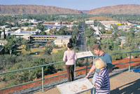 |
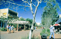 |
 |
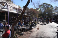 |
|
| Explorers Way - the
Northern Territory sectIon from Darwin
Darwin - End or Start of the Explorers Way
Berrimah
Palmerston
Howard Springs
Turn off onto the Arnhem Highway to Kakadu National
Park
Berry Springs
Noonamah
Lake Bennett
Turn off to Batchelor then onto Litchfield National
Park
Adelaide River - On the Explorers Way
Hayes Creek - On the Explorers Way
Emerald Springs Roadhouse - On the Explorers Way
Pine Creek - On the Explorers Way
Katherine - On the Explorers Way
Mataranka - On the Explorers Way
Larrimah - On the Explorers Way
Daly Waters - On the Explorers Way
Hi-Way Inn - On the Explorers Way
Dunmurra - On the Explorers Way
Newcastle Waters - On the Explorers Way
Elliott - On the Explorers Way
Renner Springs - On the Explorers Way
Sturt memorial - On the Explorers Way
John Flynn Memorial - On the Explorers Way
Three Ways - On the Explorers Way
Tennant Creek - On the Explorers Way
Devils Marbles reserve - On the Explorers Way
Wauchope - On the Explorers Way
Wycliffe Well - On the Explorers Way
Barrow Creek - On the Explorers Way
TiTree - On the Explorers Way
Aileron - On the Explorers Way
Alice Springs - On the Explorers Way
|
|
|
|
|
Find a self drive 4wd hire, camper,
motorhome or camper rental from Alice Springs
to Uluru and return or oneway to Darwin via
Kakadu and Litchfield.
See our specials at Australia
4wd Rentals or email
and ask us. Minimum rental is 5 days. Ask
us how to reserve a vehicle for only AUD $100
up to 9 months from travel.


|
|
|
Photographs Courtesy Of: NTTC
- Northern Territory Tourism Commission.
Maps Courtesy Of: NTTC - Northern Territory
Tourism Commission.
Photographs Courtesy Of: PJ B &
M Hutchinson Private Collections
Information courtesy of Parks and Wildlife Service NT
for the promotion of tourism for the Larapinta Trail.
Photographs
Courtesy of NTTC - Northern Territory
Tourism Commission
Information
courtesy of Parks Northern Territory
The Goholi
Our Mission Statement
As one of Australia's largest licensed
Travel Agents Goholi is dedicated to campervan and motorhome
hire and rentals. We will source the different options
for you. We will look at all the extras and find the
best vehicle package for you or even a multiple option
for you to choose from. With our head Office in the
heartland of the Top End of Darwin we can advise you
of the current situations of Uluru Kata Tjuta National
Park - Ayers Rock, Watarrka National Park, West MacDonnell
Ranges, East MacDonnell Ranges, Kakadu National Park,
Uluru (Ayers Rock), Gibb River Road Western Australia
and the - Erldunda - Kulgera - Oodnadatta Track - Coober
Pedy (Opal field) - Woomera - Port Augusta areas.
East MacDonnell National Park
and West MacDonnell National Park
in the MacDonnell Ranges in Northern Territory, Central
Australia
A tourist selfdrive tourist guide and travel information
East MacDonnell National Park
and West MacDonnell National Park in Central Australia
West
MacDonnell Map West
MacDonnell National Park East
MacDonnell National-Park
East
MacDonnell Map
West MacDonnell National Park
and surrounding areas
Larapinta
Trail Glen
Helen Gorge Glen
Helen Lodge accommodation Ellery
Creek Big Hole Ochre
Pits Ormiston
Gorge Redbank
Gorge Waterhole Roma
Gorge Serpentine
Chalet Serpentine
Gorge Simpsons
Gap Standley
Chasm
Honeymoon
Gap Palm
Valley
Albert
Namatjiras Monument
Namatjira
Drive Namatjira
Twin Gums Hermannsburg
Ghost
Gum Wallace
Rockhole Palm
Valley
East MacDonnell National Park
and surrounding areas
Arltunga
Historical Reserve and hotel or camping Trephina
Gorge Emily
Jessie Gap Corroboree
Rock Ross
River Resort Ruby
Gap N'Dhala
Gorge Nature Reserve Gemtree
Chambers
Pillar Rainbow
Valley
Other Highways, Scenic Routes,
Ways, offroad 4wd Tracks and Roads in Central Australia
The
Mereenie Loop Red
Centre Way Explorers
Way Stuart
Highway Ernest
Giles Road Namatjira
Drive Larapinta
Drive Luritja
Road Lasseter
Highway Binns
Track
Top End - Natures Way in Northern
Territory Australia
Darwin
Tropical
Darwin Map
of Northern Territory Katherine
Gorge Tennant
Creek Devils
Marbles Kakadu
National Park Natures
Way Top End Katherine
Gorge Litchfield
National Park
Alice Springs and Uluru and on
the way
Alice
Springs Alice
Springs Airport The
Ghan Alice Springs Alice
Springs Heavitree Gap Uluru
Kata Tjuta National Park
Uluru
Ayers Rock Ayers
Rock Resort at Yulara Voyages
Resort at Ayers Rock Resort, Yulara Ayers
Rock Airport 'Connellan Airport' Kata
Tjuta 'The Olgas' Sounds
of Silence dinner Mount
Sonder Mount
Connnor Mount
Ebenezer Curtin
Springs Stuarts
Well Erldunda
Kings Canyon
Watarrka
National Park Kings
Canyon Kings
Creek Station Kings
Canyon Resort Glen
Helen Lodge accommodation
Remote access sites
Henbury
Meteorites Conservation Reserve Gosse
Bluff Tnorala Tylers Pass Haasts
Bluff - lkuntji
Alice Springs camper hire and
Alice Springs motorhome rentals return and one way
Alice
Springs campervan hire and camper rentals
Alice Springs
motorhome hire and RV rentals
Alice Springs 4wd hire | Alice
Springs 4 wheel drive rentals | Alice Springs 4X4 hire
4WD Hire
from Alice Springs with oneways to Darwin
Uluru guided camping tours and
Kakadu guided camping safaris
Across Australia
Adventure Tours at http://www.australia4tours.com/
Uluru
Northern Territory www.uluruadventuretours.com
Kakadu
Northern Territory adventure tours and safaris at www.kakaduadventuretours.com
Way outback
Ayers Rock adventure tours and safaris at www.ulurusafaris.com
Way outback
Kakadu and Litchfield adventure tours and safaris at
www.kakadusafaris.com
Instant availability
on Kakadu and Top End one day tours www.kakaduholidays.com/
Instant
availability on Darwin one day tours www.darwin4tours.com/
Search, find and about West
MacDonnell National Park and East MacDonnell National
Park the MacDonnell Ranges in Central Australia a resource
travel guide.
|
|
|