|
|
|
The 4WD Dirt Offroad Tracks
and Unsealed Roads of
Central Australia Mereenie Loop Road
(Now part of the Red Centre Way)
|
|
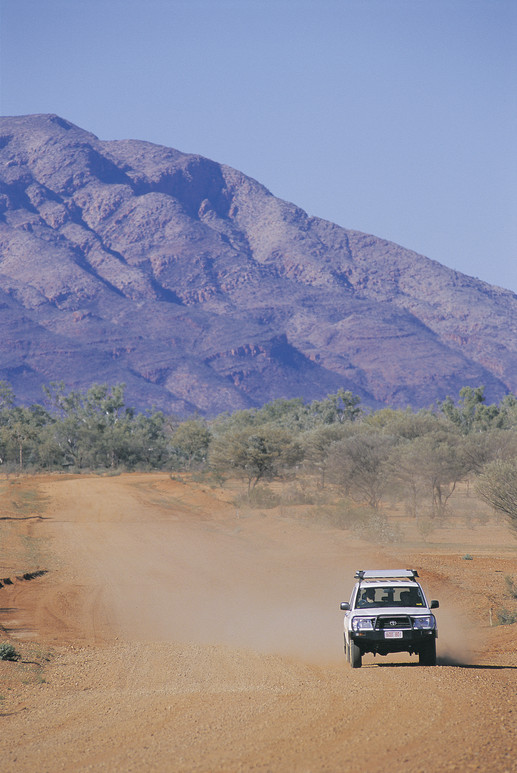
Mereenie Loop
Update 28.06.2017: I just rang Glen helen Homestead
and was told the 145klm road from Glen Helen to Kings
Canyon part of the Mereenie Loop is still not sealed
and is a dirt road still.
Other areas upgrades have been made appartently.
Update 06/04/2017:
www.alicespringsnews.com.au/
The opening of the all-bitumen
Inner Mereenie Loop
Content Alice Springs News: The government has not
sealed the mere six kilometers from the loop road
to Gosses Bluff / Tnorala (at top, and below), limiting
the track to 4WD, and shutting out anyone in a 2WD
as well as anyone towing a caravan, the categories
dominant in the vehicles we saw on the loop, from
one of the pearls in our tourism crown, and one of
the reasons for completing the loop seal.
SO the outer Mereenie Loop the one we use in the
4wd industry is still unsealed. best to check with
the Alice Springs Vistor information Centre when you
wish to go.
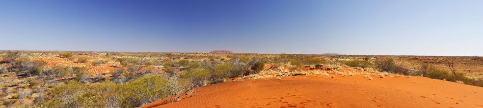
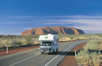
The Mereenie Loop provides for an alternative scenic
route from Alice Springs to Watarrka (Kings Caynon)
and Uluru (Ayers Rock) via the Western Macs. The loop
is recommended for 4x4 as weather conditions make
the road conditions difficult for standard vehicles.
Fuel is available at Glen Helen, Hermannsburg, Kings
Creek Station, Ayers Rock Resort.
Note: The 4WD Dirt Offroad Tracks and Unsealed Roads
of Central Australia Mereenie Loop Road (Now part
of the Red Centre Way)
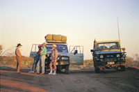
If you are travelling west from Alice Springs, the
unsealed dirt road called 'Mereenie Loop Road'
links the West MacDonnell Ranges of central Australia
with Hermannsburg, also Palm Valley and Glen Helen
with the Watarrka National Park and offers
an a true outback scenic route for self drive four
wheel drive rentals and 4wd camper hire from Alice
Springs.
The condition of Mereenie Loop Road surface is dirt
and unsealed is seasonal with flash flooding with
access sometimes limited due to weather and traffic.
Caravans, 2wd cars vehicles and 2wd trailers are not
recommended. A 4wd vehicle is essential for self drive
hires travelling to Palm Valley and Gosse Bluff from
Alice Springs.
It is advisable to contact the Police +61 (0) 8-8951
8888) to obtain current conditions and information
on road before commencing.
|
|
 A
permit is required to travel the Mereenie Loop and
can be purchased from The Visitor Centre, Glen Helen
Resort, Hermannsburg Petrol Station and Kings Canyon
Resort. A
permit is required to travel the Mereenie Loop and
can be purchased from The Visitor Centre, Glen Helen
Resort, Hermannsburg Petrol Station and Kings Canyon
Resort.
Photo courtesy - Tourism NT.
Where do I purchase a Meerenie Loop Permit and how
much is it?
The cost is $5.00.
Permits to be purchased in person.
Tourism Central Australia Visitor Information
Centre Gregory Terrace, Alice Springs
Phone: (08) 8952 5800
Open: MonFri 8.00am-5.00pm; Sat-Sun and Public Holidays
9.00am-4.00pm
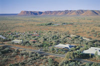
Glen Helen Resort
Namatjira Drive, Alice Springs
Phone: (08) 8956 7489
Open: Daily 7.00am10.00pm
Hermannsburg Petrol Station
Larapinta Drive, Alice Springs
Phone: (08) 8956 7480
Open: Mon-Sat 8.30am-5.30pm; Sun 10.00am5.30pm
Kings Canyon Resort
Watarrka National Park
Phone: (08) 8956 7442
Open: Daily 6.30am9.30pm
|
|
|
|
|
The
Red Centre Way
To Uluru - Ayers Rock, Kata Tjuta - the Olgas, Mereenie
loop, Kings Canyon
in Northern Territory
Australia
A tourist selfdrive hire guide and information
|
|
|
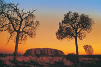
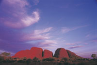
Uluru, also known as Ayers Rock
Welcome to Aboriginal land
Pukulngalya yanama, Ananguku Ngurakutu (welcome
greeting in Yankunytjatjara)
Pukulpa Pitjama, Ananguku Ngurakutu
(welcome greeting in Pitjantjatjara)
The traditional land owners of Uluru-Kata Tjuta National
Park, are direct descendants of the beings who created
our lands during the Tjukurpa (Creation Time). We have
always been here. We call ourselves Anangu, and would
like you to use that term for us.
Uluru-Kata Tjuta National Park is a world-class visitor
destination and a key part of Australia's iconic Red
Centre. This living cultural landscape is the physical
and metaphoric heart of Australia, and was one of the
first areas to be identified as a National Landscape.
Ayres rock Uluru, also referred to as Ayers Rock, is
a large sandstone rock formation in the southern part
of the Northern Territory, central Australia. It lies
335 km (208 mi) south west of the nearest large town,
Alice Springs; 450 km (280 mi) by road. Kata Tjuta (The
Olgas) and Uluru are the two major features of the Uluru
- Kata Tjuta National Park. Uluru is sacred to the Pitjantjatjara
and Yankunytjatjara, the Aboriginal people of the area.
It has many springs, waterholes, rock caves and ancient
paintings. Uluru is listed as a World Heritage Site.
The local Pitjantjatjara people call the landmark Uluru
. This word has no particular meaning in their dialect,
also known as Pitjantjatjara, but it is also used as
a local family name by the senior Traditional Owners
of Uluru.
On 19 July 1873, the surveyor William Gosse visited
Uluru and named it Ayers Rock in honour of the then-Chief
Secretary of South Australia, Sir Henry Ayers. Since
then, both names have been used, although Ayers Rock
was the most common name used by outsiders until recently.
In 1993, a dual naming policy was adopted that allowed
official names that consist of both the traditional
Aboriginal name and the English name.
On 15 December 1993, it was renamed "Ayers Rock/Uluru"
and became the first officially dual-named feature in
the Northern Territory. The order of the dual names
was officially reversed to "Uluru/Ayers Rock" on 6 November
2002 following a request from the Regional Tourism Association
in Alice Springs.
Uluru is one of Australia's most recognisable natural
icons. The world-renowned sandstone formation stands
348 m (1,142 ft) high (863 m/2,831 ft above sea level)
with most of its bulk below the ground, and measures
9.4 km (5.8 mi) in circumference. Uluru is notable for
appearing to change colour as the different light strikes
it at different times of the day and year, with sunset
a particularly remarkable sight when it briefly glows
red. Although rainfall is uncommon in this semiarid
area, during wet periods the rock acquires a silvery-grey
colour, with streaks of black algae forming on the areas
that serve as channels for water flow. Uluru is an inselberg,
literally "island mountain", an isolated remnant left
after the slow erosion of an original mountain range.
Uluru is also often referred to as a monolith, although
this is a somewhat ambiguous term because of its multiple
meanings, and thus a word generally avoided by geologists.
The strata at Uluru are nearly vertical, dipping to
the south west at 85°, and have an exposed thickness
of at least 2,400 m (7,900 ft). The strata dip below
the surrounding plain and no doubt extend well beyond
Uluru in the subsurface, but the extent is not known.
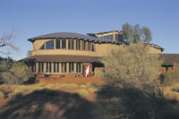
Cultural Centre
When you visit Uluru - Kata Tjuta National Park, you
should ensure that you explore the Cultural Centre first.
You will enjoy exploring the Park much more if you understand
Anangu culture and this very special cultural and natural
environment. At the Cultural Centre you can get an introduction
to Tjukurpa (law, knowledge, religion, philosophy),
Anangu art, Anangu way of life (traditional and current),
history, languages, wildlife and joint management of
the Park. The displays feature photo collages, oral
history sound panels, Pitjantjatjara language learning
interactives, soundscapes, videos and artefacts. There
are bush tucker sessions, plants walks and cultural
sessions for visitors to experience. Cultural Centre
notes are provided in Pitjantjatjara, English, Italian,
Japanese, German and French. A touch wall for visually
impaired people ensures that the messages are accessible
to everyone. Daily schedules vary, so ask at the Cultural
Centre Information Desk. Park
Fees
|
 |
 |
 |
 |
 |
 |
|
|
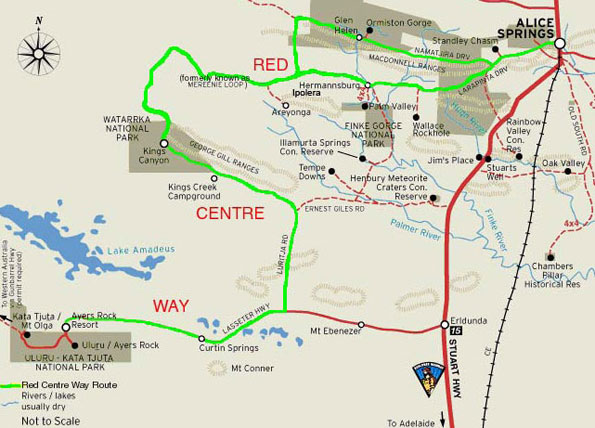
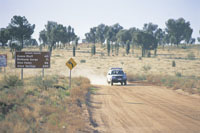
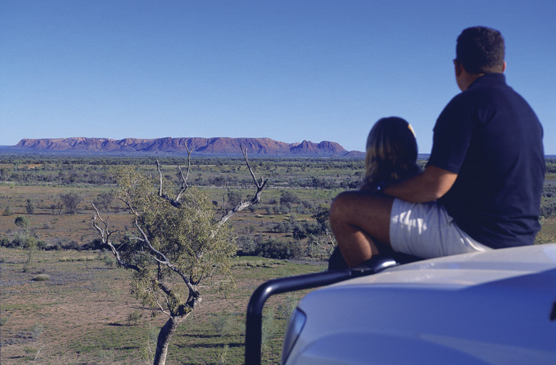
The Mereenie Loop - Red Centre Way (formerly
Mereenie Loop Road)
The route runs initially along a minor loop encompassing
Larapinta and Namatjira Drives through Aboriginal land-holdings
from Alice Springs on to Glen Helen or Hermannsburg,
thereafter becoming a single road progressing on to
Kings Canyon. From there Luritja Road runs down to join
up with the Lasseter Highway, feeding off the Stuart
Highway at Erldunda and on to Uluru. The route passes
through some of the Northern Territorys most spectacular
countryside, and also offers an alternate route for
visitors travelling to and from Uluru and Alice Springs.
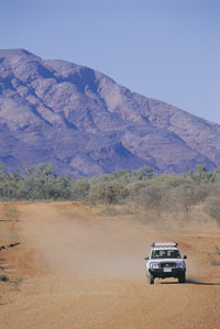
The Mereenie Loop Road
The Mereenie Loop Road is an unsealed road for 197km
of 337km, a 4WD is required.
This drive is one that memories are made off and photo's
will fill your home with. Imagine the 4 great Central
Australian icons areas all in one trip being Alice Springs,
Kings Canyon, Kata Tjuta (formerley known as The Olgas)
and Uluru (formerley known as Ayers Rock) . The Red
Centre Way is the gateway to an abundance of natural
and aboriginal attractions through the ancient heart
of the Australian outback. Allow a minimum of 5 to 7
days for this journey through red desert sands, spinifex
and mulga forest.
Red Centre Way 5 Day Intinerary
Alice Springs to Glen Helen, 130 kms.
Glen Helen to Kings Canyon, 260 kms.
Kings Canyon to Uluru, 300 kms.
Continue experiencing Uluru and Kata Tjuta.
Uluru to Alice Springs, 445 kms. Highlights along the
way include Glen Helen Gorge, the Gardner Range, Finke
Gorge, Mount Connor and Palm Valley. 4WD is recommended
on the Meerenie, although conventional cars have been
known to survive the trip. My advice is drive slow -
veyr slow and enjoy the view (RAB2009)
Permits To Drive On the Mereenie
Loop Through Aboriginal Lands
The Loop will take you through areas where ten distinct
Aboriginal languages are spoken. Also, a permit is required
to travel on the Loop. You can obtain them from the
Central Land Council in Alice Springs ([08] 8953 4345),
Glen Helen Resort, Hermannsburg Petrol Station and Kings
Canyon Resort. The permit costs just $5.
|
 |
 |
 |
|
|
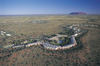
Ayers Rock Resort
Regardless of where you stay while you're at Voyages
Ayers Rock Resort, from the sanctuary of one of the
five hotels, or the intimacy of Voyages Ayers Rock Resort
Campground, you can experience the beauty of the living
cultural landscape of Uluru-Kata Tjuta National Park,
in Australia's Northern Territory. With over 65 tours,
local activities and attractions within the Resort and
the Uluru-Kata Tjuta National Park, your days will be
action-packed. Ride a camel across the desert dunes.
Hop on a Harley, or embark on a base walk of Uluru (Ayers
Rock).
Getting There
Ayers Rock Resort Airport Fly direct to the heart of
Australia ... You can fly daily from Perth, Sydney,
Cairns and Alice Springs direct to Ayers Rock Airport.
Direct flights operate twice a week from Melbourne.
Flights from Darwin and Brisbane connect from Alice
Springs through to Ayers Rock Airport. Ayers Rock Airport
is conveniently located just six kilometres from Voyages
Ayers Rock Resort (10 minutes' travel). The airport
services both fixed and rotary winged aircraft and receives
up to on average 350,000 - 400,000 commercial passengers
per year. It's also a popular stopping off point for
private pilots and passengers travelling in their own
aircraft. From Ayers Rock Airport, you can enjoy scenic
desert flights over Uluru and Kata Tjuta. You will find
hire car companies, tour desks, a Qantas desk, Ayers
Rock Design retail outlet, and an information desk at
the airport.
Airport Transfers - Complimentary return coach transfers
from Ayers Rock Airport to Voyages Ayers Rock Resort
meet every scheduled flight. The return transfer to
Ayers Rock Resort Airport collects you from your hotel
approximately 2 hours prior to flight departure please
check with reception for exact time. http://www.ayersrockresort.com.au/
|
 |
 |
|
|
|
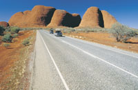
| Kata
Tjuta (The Olgas)Both Uluru and Kata Tjuta have
great cultural significance for the Anangu Traditional
landowners, who lead walking tours to inform visitors
about the local flora and fauna, bush foods and the Aboriginal
dreamtime stories of the area. Kata Tjuta, also called
Mount Olga or The Olgas owing to its peculiar formation,
is another rock formation about 25 km (16 mi) from Uluru.
Special viewing areas with road access and parking have
been constructed to give tourists the best views of both
sites at dawn and dusk. The rock was originally sand,
deposited as part of an extensive alluvial fan that extended
out from the ancestors of the Musgrave, Mann and Petermann
Ranges to the south and west, but separate from a nearby
fan that deposited the sand, pebbles and cobbles that
now make up Kata Tjuta. The similar mineral composition
of the Mutitjulu Arkose and the granite ranges to the
south is now explained. |
 |
 |
|
|
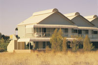
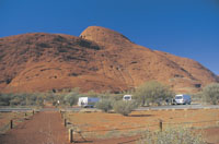
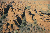
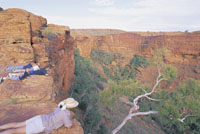
Kings Canyon in Watarrka National Park
Voyages Kings Canyon Resort is located in a loop off
the main highway running between Ayers Rock and Alice
Springs. The sensitively designed resort is just seven
kilometres from Watarrka National Park, the home of
the magical sandstone formation of Kings Canyon.
Due to Voyages commitment to best environmental practice,
the resort has been built to blend harmoniously with
the surrounds. Kings Canyon Resort offers a wide range
of accommodation from the campground that enjoys the
outdoor stillness of the Red Centre to deluxe spa rooms
- offering understated comfort rather unexpected in
such a remote location.
It is the perfect oasis from which to explore the
wonders of Kings Canyon including the amazing rock formation
called the Lost City and the Garden of Eden an oasis
of an entirely different kind at the foot of the Canyon.
The flora of Kings Canyon offers a clear indication
that the climate of this whole area was once vastly
different.
Getting There
There is no better way to explore Central Australia
then at your own pace. As Kings Canyon lies just 3 hours
from Uluru (Ayers Rock) and approx. 4 hours from Alice
Springs, self drive is a popular option. The drive passes
some incredible sites including Standley Chasm, Ellery
Creek and Ormiston Gorge.
The Mereenie Loop Road brings you right to the doorstep
of the Resort. Please note: the Mareenie Loop Road is
an unsealed road for 197km of 337km, a 4WD is required.
Alternatively travel via the Stuart Highway, approx.
distance from Alice Springs to Kings Canyon 461km and
4.5 hours travelling time. http://www.kingscanyonresort.com.au/
|
 |
 |
 |
|
|
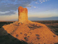
The Simpson Desert
The Simpson Desert, southeast of Alice Springs is one
of Australia's great wilderness areas containing giant
red sand dunes and interesting rock formations such
as Chambers Pillar and Rainbow Valley.
|
 |
|
|
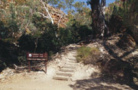
Larapinta Trail
The 223 km long Larapinta Trail follows the West MacDonnell
Ranges and is considered among the world's great walking
experiences.
|
 |
|
|
The Alice Springs Desert Park
The Alice Springs Desert Park was created to educate
visitors on the many facets of the surrounding desert
environment.
A must see for every visitor to Alice! In the space
of just a few hours, you can discover many of the secrets
of the Central Australian deserts at the Desert Park.
Hundreds of species of plants and animals found across
Central Australian deserts can be seen, smelt and heard.
You will even have the opportunity to experience desert
habitats as they are at night, seeing some of the animals
near impossible to see in the wild.
Take an easy walking trail through three desert habitats
and discover Desert Rivers, Sand Country and the Woodland
habitat, witness free-flying birds of prey in the nature
theatre, see rare and endangered animals in the spectacular
nocturnal house, hear the insights into the interlinking
world of plants, animals and people from our local guides
and enjoy a cinematic journey through four-and-a-half
billion years of desert evolution during the 20 minute
cinematic journey of The Changing Heart. When you
leave the Desert Park you will go away with new stories,
skills and some of the secrets of the desert. www.alicespringsdesertpark.com.au/
|
 |
|
|
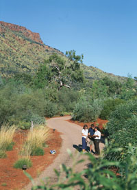
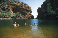
The MacDonnell Ranges
The MacDonnell Ranges run east and west of Alice Springs
and contain a number of hiking trails and swimming holes
such as Ormiston Gorge, Ormiston Gorge Creek, Red Bank
Gorge and Glen Helen Gorge.
|
 |
|
 |
|
|
|
|
|
|
|
Find a self drive 4wd hire, camper,
motorhome or camper rental from Alice Springs
to Uluru and return or oneway to Darwin via
Kakadu and Litchfield.
See our specials at Australia
4wd Rentals or email
and ask us. Minimum rental is 5 days. Ask
us how to reserve a vehicle for only AUD $100
up to 9 months from travel.


|
|
https://www.wotif.com/Activities?affcid=wotif-AU.network.phg.goholi.hotels&afflid=1011l4hPS895&ref_id=1011l4hPS895&my_ad=wotif-AU.network.phg.goholi.hotels&my_publisher=goholi  |
|
Photographs Courtesy Of: NTTC
- Northern Territory Tourism Commission.
Maps Courtesy Of: NTTC - Northern Territory
Tourism Commission.
Photographs Courtesy Of: PJ B &
M Hutchinson Private Collections
Information courtesy of Parks and Wildlife Service NT
for the promotion of tourism for the Larapinta Trail.
Photographs
Courtesy of NTTC - Northern Territory
Tourism Commission
Information
courtesy of Parks Northern Territory
The Goholi
Our Mission Statement
As one of Australia's largest licensed
Travel Agents Goholi is dedicated to campervan and motorhome
hire and rentals. We will source the different options
for you. We will look at all the extras and find the
best vehicle package for you or even a multiple option
for you to choose from. With our head Office in the
heartland of the Top End of Darwin we can advise you
of the current situations of Uluru Kata Tjuta National
Park - Ayers Rock, Watarrka National Park, West MacDonnell
Ranges, East MacDonnell Ranges, Kakadu National Park,
Uluru (Ayers Rock), Gibb River Road Western Australia
and the - Erldunda - Kulgera - Oodnadatta Track - Coober
Pedy (Opal field) - Woomera - Port Augusta areas.
East MacDonnell National Park
and West MacDonnell National Park
in the MacDonnell Ranges in Northern Territory, Central
Australia
A tourist selfdrive tourist guide and travel information
East MacDonnell National Park
and West MacDonnell National Park in Central Australia
West
MacDonnell Map West
MacDonnell National Park East
MacDonnell National-Park
East
MacDonnell Map
West MacDonnell National Park
and surrounding areas
Larapinta
Trail Glen
Helen Gorge Glen
Helen Lodge accommodation Ellery
Creek Big Hole Ochre
Pits Ormiston
Gorge Redbank
Gorge Waterhole Roma
Gorge Serpentine
Chalet Serpentine
Gorge Simpsons
Gap Standley
Chasm
Honeymoon
Gap Palm
Valley
Albert
Namatjiras Monument
Namatjira
Drive Namatjira
Twin Gums Hermannsburg
Ghost
Gum Wallace
Rockhole Palm
Valley
East MacDonnell National Park
and surrounding areas
Arltunga
Historical Reserve and hotel or camping Trephina
Gorge Emily
Jessie Gap Corroboree
Rock Ross
River Resort Ruby
Gap N'Dhala
Gorge Nature Reserve Gemtree
Chambers
Pillar Rainbow
Valley
Other Highways, Scenic Routes,
Ways, offroad 4wd Tracks and Roads in Central Australia
The
Mereenie Loop Red
Centre Way Explorers
Way Stuart
Highway Ernest
Giles Road Namatjira
Drive Larapinta
Drive Luritja
Road Lasseter
Highway Binns
Track
Top End - Natures Way in Northern
Territory Australia
Darwin
Tropical
Darwin Map
of Northern Territory Katherine
Gorge Tennant
Creek Devils
Marbles Kakadu
National Park Natures
Way Top End Katherine
Gorge Litchfield
National Park
Alice Springs and Uluru and on
the way
Alice
Springs Alice
Springs Airport The
Ghan Alice Springs Alice
Springs Heavitree Gap Uluru
Kata Tjuta National Park
Uluru
Ayers Rock Ayers
Rock Resort at Yulara Voyages
Resort at Ayers Rock Resort, Yulara Ayers
Rock Airport 'Connellan Airport' Kata
Tjuta 'The Olgas' Sounds
of Silence dinner Mount
Sonder Mount
Connnor Mount
Ebenezer Curtin
Springs Stuarts
Well Erldunda
Kings Canyon
Watarrka
National Park Kings
Canyon Kings
Creek Station Kings
Canyon Resort Glen
Helen Lodge accommodation
Remote access sites
Henbury
Meteorites Conservation Reserve Gosse
Bluff Tnorala Tylers Pass Haasts
Bluff - lkuntji
Alice Springs camper hire and
Alice Springs motorhome rentals return and one way
Alice
Springs campervan hire and camper rentals
Alice Springs
motorhome hire and RV rentals
Alice Springs 4wd hire | Alice
Springs 4 wheel drive rentals | Alice Springs 4X4 hire
4WD Hire
from Alice Springs with oneways to Darwin
Uluru guided camping tours and
Kakadu guided camping safaris
Across Australia
Adventure Tours at http://www.australia4tours.com/
Uluru
Northern Territory www.uluruadventuretours.com
Kakadu
Northern Territory adventure tours and safaris at www.kakaduadventuretours.com
Way outback
Ayers Rock adventure tours and safaris at www.ulurusafaris.com
Way outback
Kakadu and Litchfield adventure tours and safaris at
www.kakadusafaris.com
Instant availability
on Kakadu and Top End one day tours www.kakaduholidays.com/
Instant
availability on Darwin one day tours www.darwin4tours.com/
Search, find and about West
MacDonnell National Park and East MacDonnell National
Park the MacDonnell Ranges in Central Australia a resource
travel guide.
|
|
|